
Dinosaur Tracks Near Moab: Walking Through the Morrison Formation
Where to see real dinosaur footprints in eastern Utah — and what this landscape looked like during the Late Jurassic, roughly 156–146 million years ago.
Words by Michele Underwood | Photos by Michele
Moab is known for mountain biking, national parks, and red rock. It’s why I’m here.
But one afternoon, I found myself staring at something that had nothing to do with slickrock or trail systems.
It was a footprint.
A real dinosaur track was pressed into stone and left there. And, I was hooked.
The World Beneath Moab
The Morrison Formation is the geologic foundation beneath much of eastern Utah — a massive layer of sedimentary rock spread across the American West. It formed during the Late Jurassic period, roughly 156–146 million years ago, when rivers carried mud, sand, and silt across broad floodplains. Those sediments hardened into rock and preserved dinosaur bones and footprints along the way.
Eastern Utah sits directly on top of this formation. During the Late Jurassic — roughly 156–146 million years ago — this wasn’t the dry, wind‑scoured desert you ride across today.
It was a landscape of rivers, floodplains, shallow lakes, and vegetation. Massive sauropods moved through wetlands. Carnivorous theropods hunted along muddy banks. Armored dinosaurs crossed open ground that would later harden into rock.
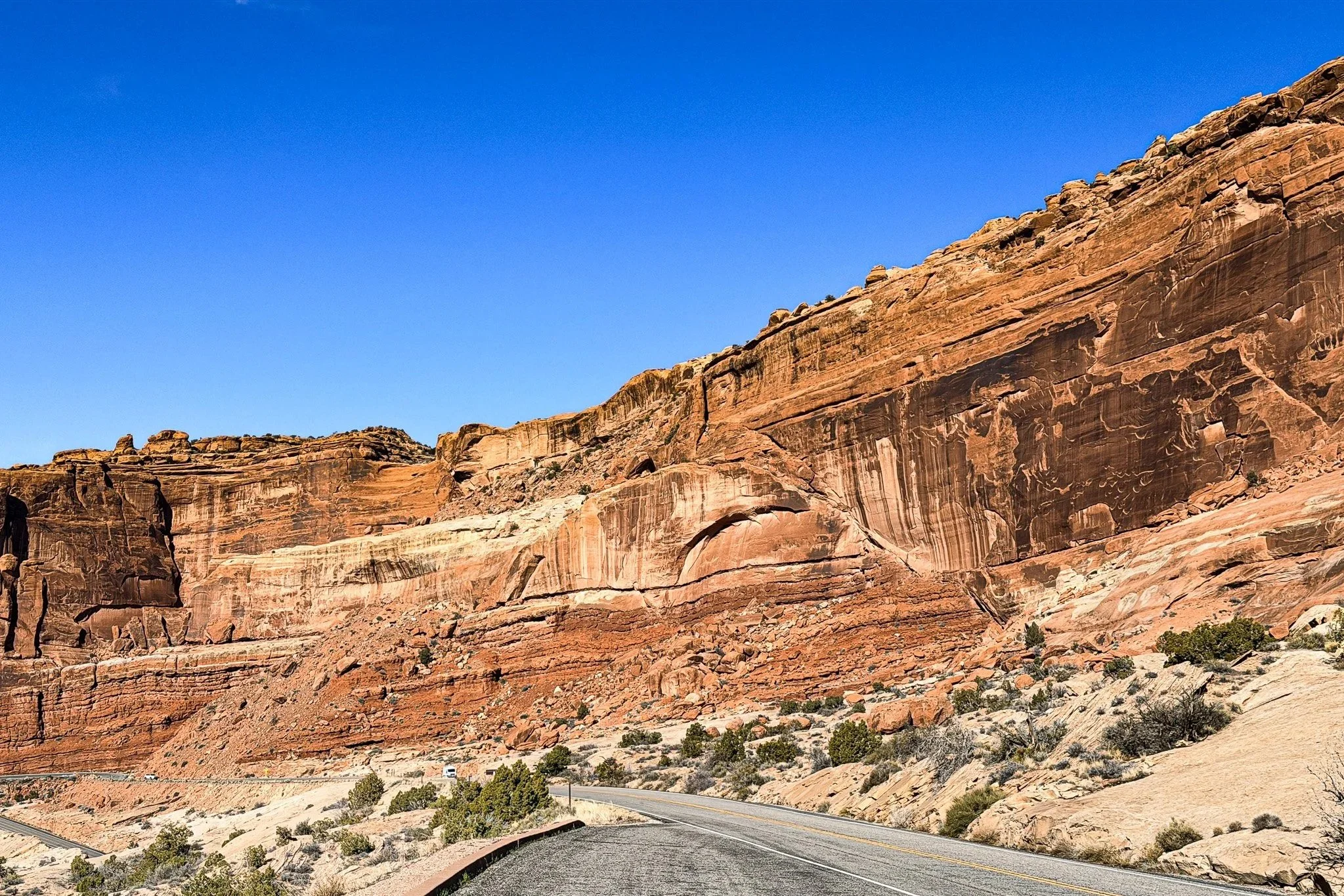
The Moab Fault visible along the drive into Arches National Park — a major geologic fracture that helped expose ancient rock layers across the region.
Over time, sediment buried their tracks. Minerals replaced organic material. Later uplift, movement along the Moab Fault, and steady desert erosion exposed those ancient surfaces again.
That’s why their steps are visible today.
If you want to understand why so much of this rock is exposed in the first place, read: The Moab Fault: The Crack That Shaped the Desert. The fault plays a major role in lifting and fracturing these layers, so erosion can reveal what’s inside.
Seeing Tracks at Poison Spider
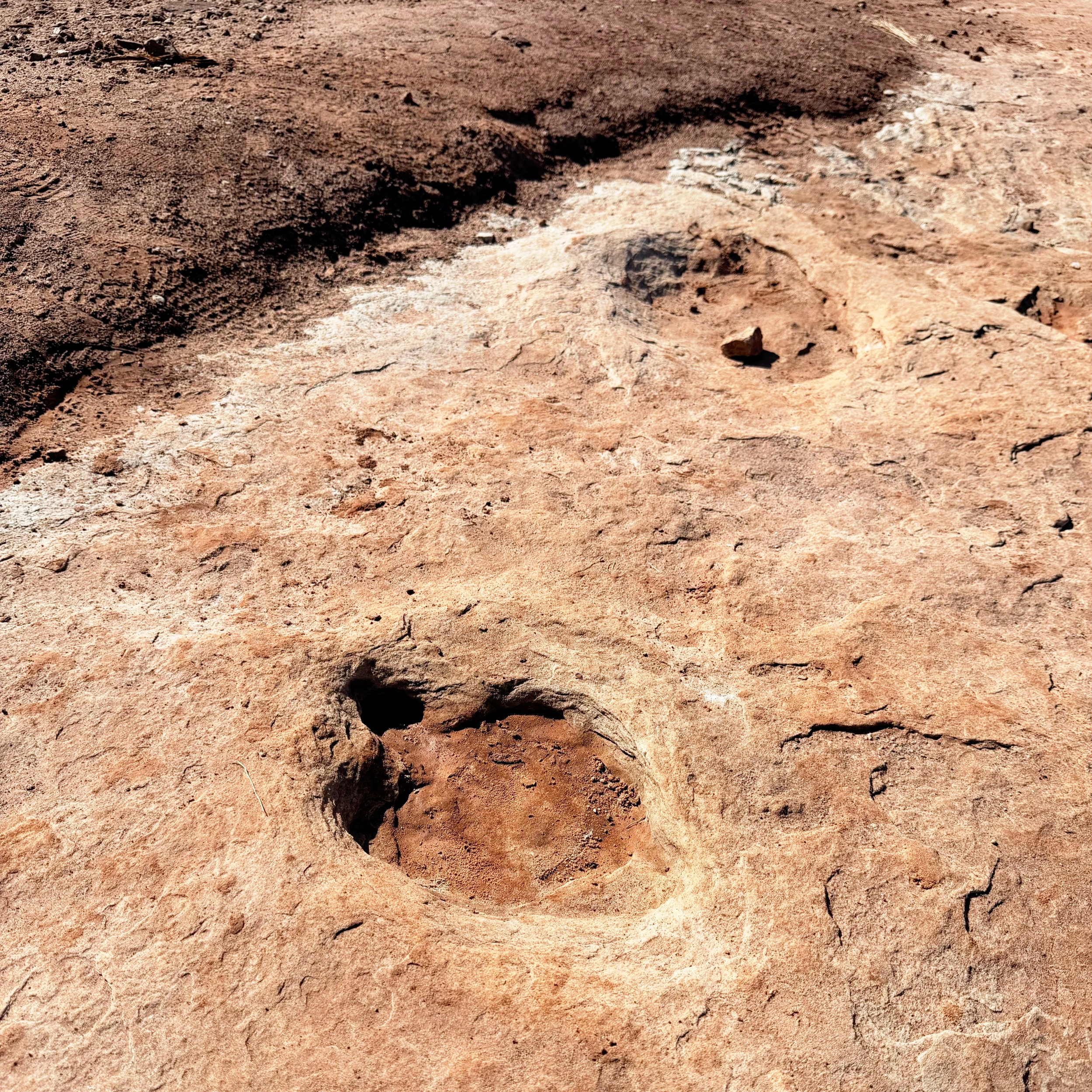
I saw my first tracks at Poison Spider Trail outside Moab.
Two large rock slabs had fallen away from a cliff face. On the underside — now horizontal and exposed — were clear three‑toed impressions. The kind you recognize immediately from textbooks. Narrow heel. Forward‑facing claws.
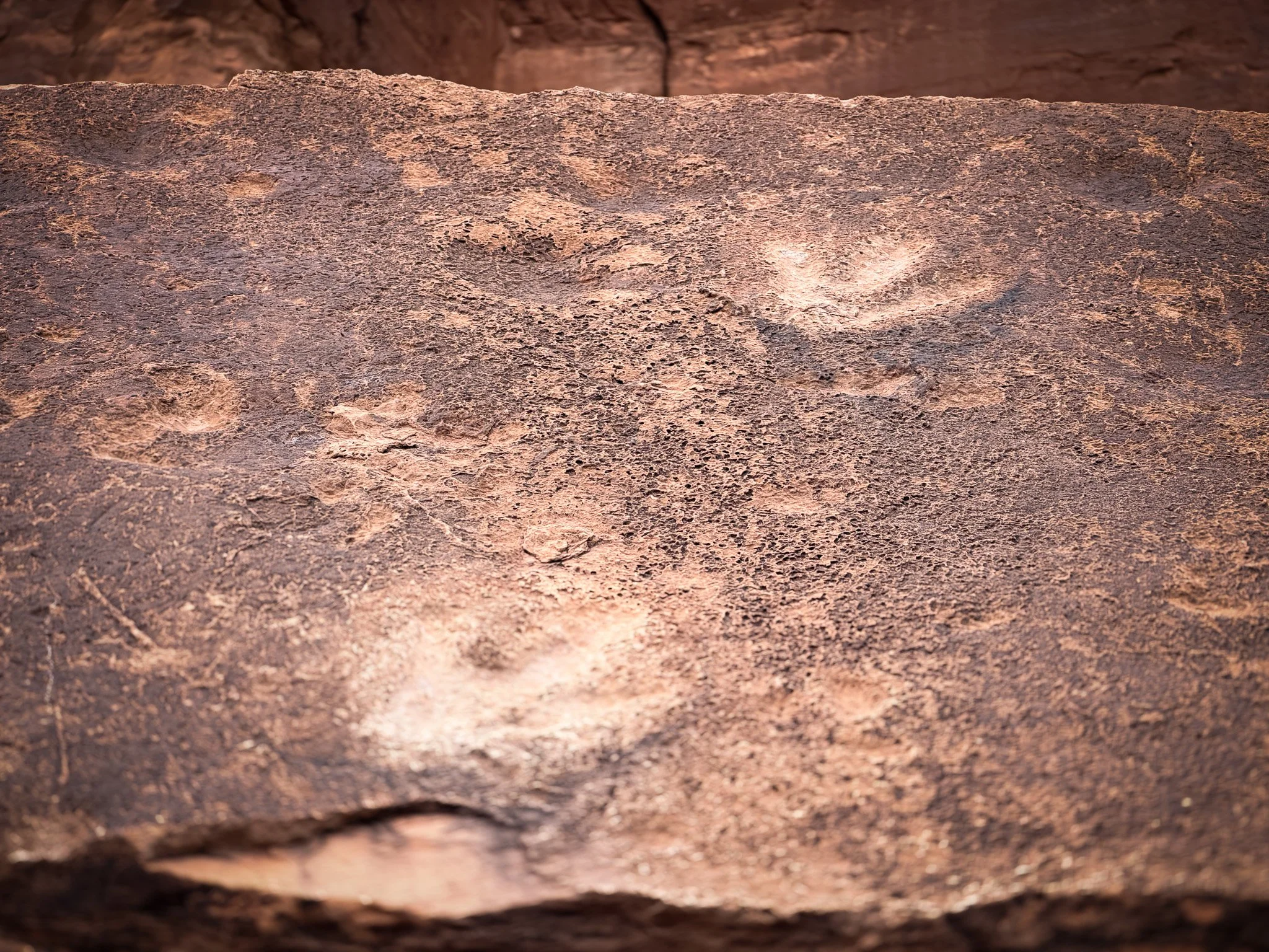
Close view of a theropod footprint at Poison Spider — narrow heel, forward claws, preserved for roughly 150 million years.
They were likely left by a theropod — a meat‑eating dinosaur walking across soft mud that later hardened and fossilized.
What struck me most wasn’t their size.
It was how unceremonious it felt.
There’s no grand entrance gate. No glass barrier. You hike a normal trail, and there they are — embedded in stone that’s been shifting for millions of years.
You’re not imagining dinosaurs. You’re standing where one stepped.
Why Moab Has So Many Fossils
The Morrison Formation stretches across much of the American West, but eastern Utah is one of its most productive fossil regions.
Several factors come together here:
Sediment-rich river systems during the Jurassic period created ideal conditions for preserving tracks and bones.
The Moab Fault and regional uplift fractured and raised rock layers over millions of years.
Desert erosion gradually stripped away overlying sediment, exposing ancient surfaces.
The same forces that shaped cliffs, fins, and mesas also revealed dinosaur history.
Dinosaur Track Sites Near Moab
Moab is commonly known for seven accessible dinosaur track sites. Here they are:
Note: Exact dinosaur species cannot usually be identified from tracks alone. Paleontologists determine general dinosaur groups based on footprint shape, size, and stride patterns rather than assigning a specific named species.
Bull Canyon Dinosaur Tracksite
Located northwest of town, this site includes visible three‑toed theropod tracks preserved on exposed sandstone surfaces.
Track Type: Theropod (three‑toed carnivorous dinosaur)
Coordinates (approx.): 38.7420° N, 109.6620° W
Copper Ridge Dinosaur Trackways
North of Moab, Copper Ridge features multiple track impressions spread across open rock, including both large sauropod and smaller theropod tracks.
Track Type: Sauropod (large, long‑necked dinosaur) and Theropod
Coordinates (approx.): 38.7390° N, 109.6500° W
Stomping Grounds Tracksite
An expansive area with numerous visible tracks preserved across a broad sandstone surface.
Track Type: Primarily Sauropod, with some Theropod impressions
Coordinates (approx.): 38.7365° N, 109.6330° W
Mill Canyon Dinosaur Tracksite
A short walk from the parking area leads to multiple visible tracks preserved in sandstone. Interpretive signage identifies different track types and explains the site's geology.
Track Type: Sauropod, Theropod, and Ornithopod (plant‑eating, bipedal dinosaurs)
Coordinates (approx.): 38.7205° N, 109.7050° W
Mill Canyon Bone Trail
Near the tracksite, interpretive signage highlights fossilized bone fragments embedded in rock. This trail is amazing. It is an outdoor living museum. The site also goes into detail about the rock layers' geology, and you can even see a petrified tree with its rings still visible. It is a very informative exhibit that tells the complete story. This is probably my favorite spot to see dinosaur stuff.
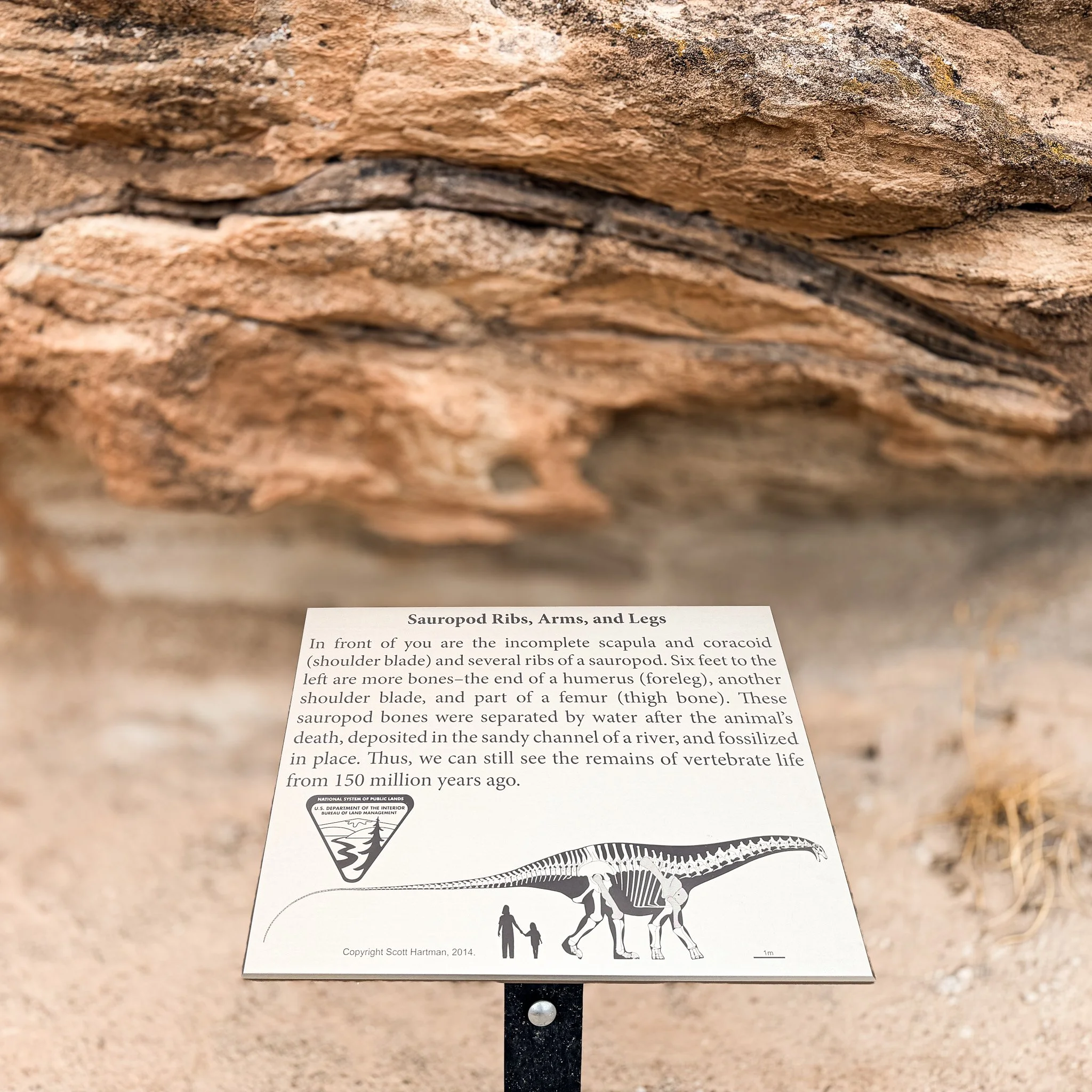
Interpretive sign at Mill Canyon Bone Trail marking preserved sauropod ribs and limb bones embedded in Jurassic sandstone.
Near the tracksite, interpretive signage highlights fossilized bone fragments embedded in rock.
Type: Fossil Bone Site
Coordinates (approx.): 38.7225° N, 109.7065° W
Poison Spider Tracksite
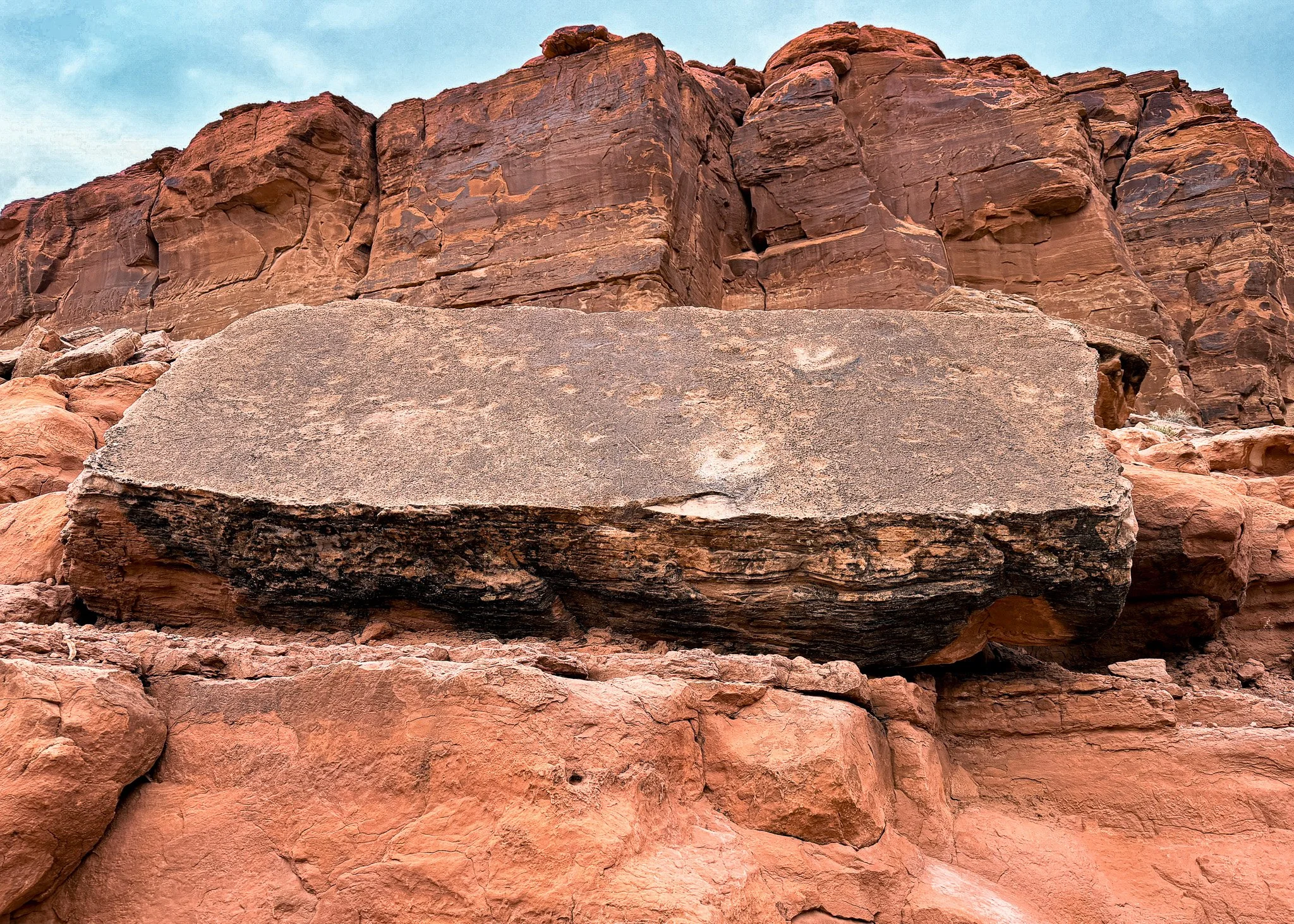
Fallen rock slab at Poison Spider Trail exposing multiple three-toed theropod tracks once pressed into soft Jurassic mud.
Along the Poison Spider Trail, fallen slabs reveal three‑toed theropod tracks exposed by erosion and rock movement.
Track Type: Theropod (three‑toed carnivorous dinosaur)
Coordinates (approx.): 38.5755° N, 109.5895° W
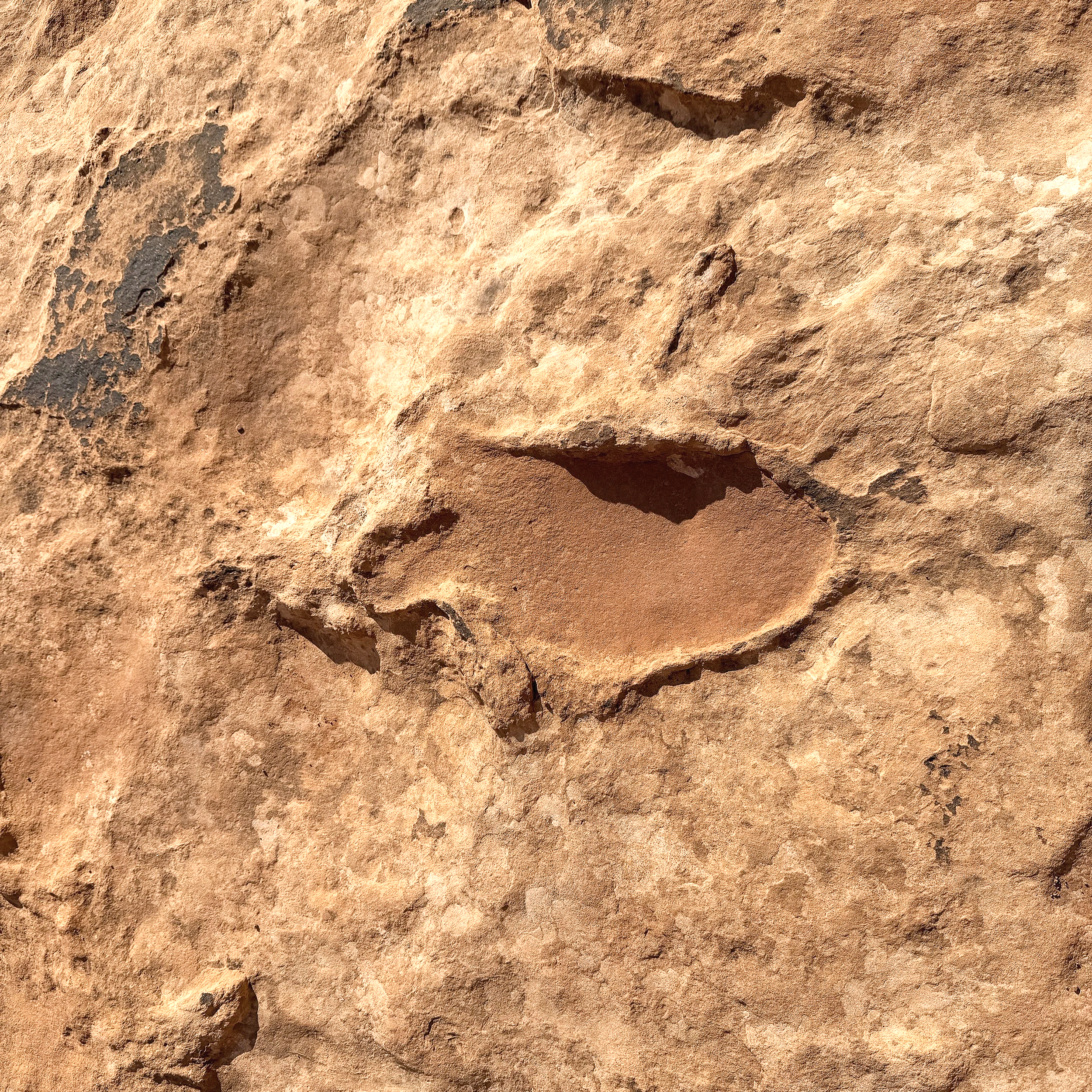
Willow Springs Dinosaur Tracksite
Large theropod footprint at Willow Springs Dinosaur Tracksite — preserved in sandstone north of Arches National Park.
Located north of Arches National Park, this site contains visible three‑toed track impressions preserved in sandstone. On this site, you can see their walking path, and I am sure underneath the desert dirt, they continue.
Track Type: Theropod (carnivorous, three‑toed dinosaurs)
Coordinates (approx.): 38.7615° N, 109.6010° W
Bonus Stop: Corona Arch
Pro tip: If you hike to Corona Arch, look down as you approach the base — several three‑toed theropod tracks are preserved in the slickrock right along the main walking path. They’re easy to miss if you’re only looking up at the arch.
Track Type: Theropod (three‑toed carnivorous dinosaur)
Coordinates (approx.): 38.5733° N, 109.5518° W
Three-toed theropod dinosaur track at the base of Corona Arch — visible right along the hiking route.
What It Changes
It’s one thing to know dinosaurs existed.
It’s another to see the exact place where one placed its foot.
Moab feels different after that.
The cliffs aren’t just dramatic backdrops. The desert isn’t just empty space between trailheads. Beneath the recreation map is a prehistoric ecosystem preserved in layers.
When you ride here or hike here, you’re crossing surfaces shaped long before any human route was drawn.
That realization stays with you.
If you’re in Moab for the biking, take a short detour. The tracks are quiet. They’re subtle. But they shift the scale of the place.
The desert holds more than scenery.
It holds deep time — layered, fractured, and slowly revealed.
More in the Moab Series
This article is part of an ongoing Moab series exploring the landscape from multiple angles — history, geology, riding, and national parks.
The Moab You Didn’t Know About: Dinosaurs, Petroglyphs & the Desert Before the Bikes
Moab’s Uranium Boom: How the Atomic Age Reshaped the Desert Town
Potash Ponds Near Moab: What Those Bright Blue Pools Really Are
The Moab Fault: The Crack That Shaped the Desert
Petroglyphs Near Moab: Where to See Rock Art & What It Means
Michele Underwood writes Overland Girl, where she shares firsthand travel experiences across the American West — from desert landscapes and national parks to small towns layered with history. Her work blends movement, place, and the stories that shape them.

Some posts may include affiliate links to products or services she uses on the road. If you choose to purchase through those links, she may earn a small commission at no additional cost to you. It helps support continued travel and storytelling. She only links to items she personally uses or would use herself.