
Best Things to Do in Capitol Reef National Park: My Favorite Hikes, Views, and Historic Spots
Firsthand experiences from exploring one of Utah’s most overlooked national parks.
Words by Michele Underwood | Photos by Michele
To start, I love national parks. I also enjoy checking out the lesser-traveled spots — from hikes and scenic viewpoints to historic sites you might otherwise miss.
The popular highlights are great, but I like seeing as much as possible because every part of a park can reveal something different.
Below are the places in Capitol Reef National Park that left the biggest impression on me — the hikes, viewpoints, and historic spots I enjoyed most while exploring the park.
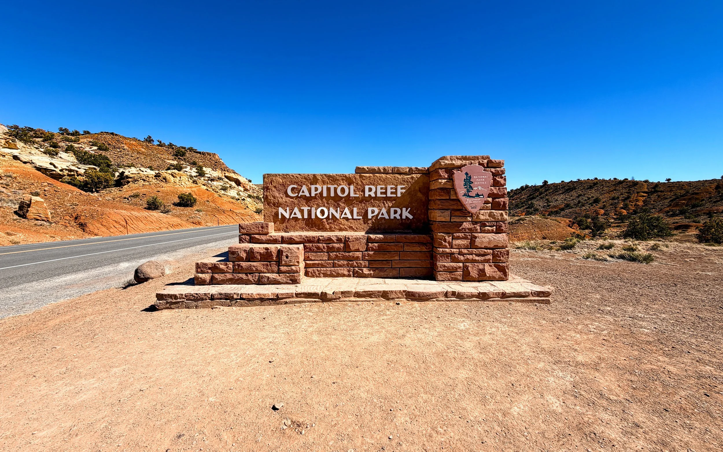
Entrance sign for Capitol Reef National Park along Highway 24 in southern Utah.
My Favorite Things to Do in Capitol Reef National Park
Capitol Reef National Park is one of Utah’s quieter parks, but there’s a lot to see if you slow down and explore. From historic orchards and scenic hikes to pioneer carvings hidden in canyon walls, these were the things I enjoyed most during my time in the park.
1. Capitol Reef Visitor Center
I always start at the visitor center when I enter a national park.
These centers are really the heart of the park experience. The visitor center at Capitol Reef has a mid-20th-century modern architectural feel. It’s not a large space, but it provides a lot of useful information about the park’s geology, history, and landscape.
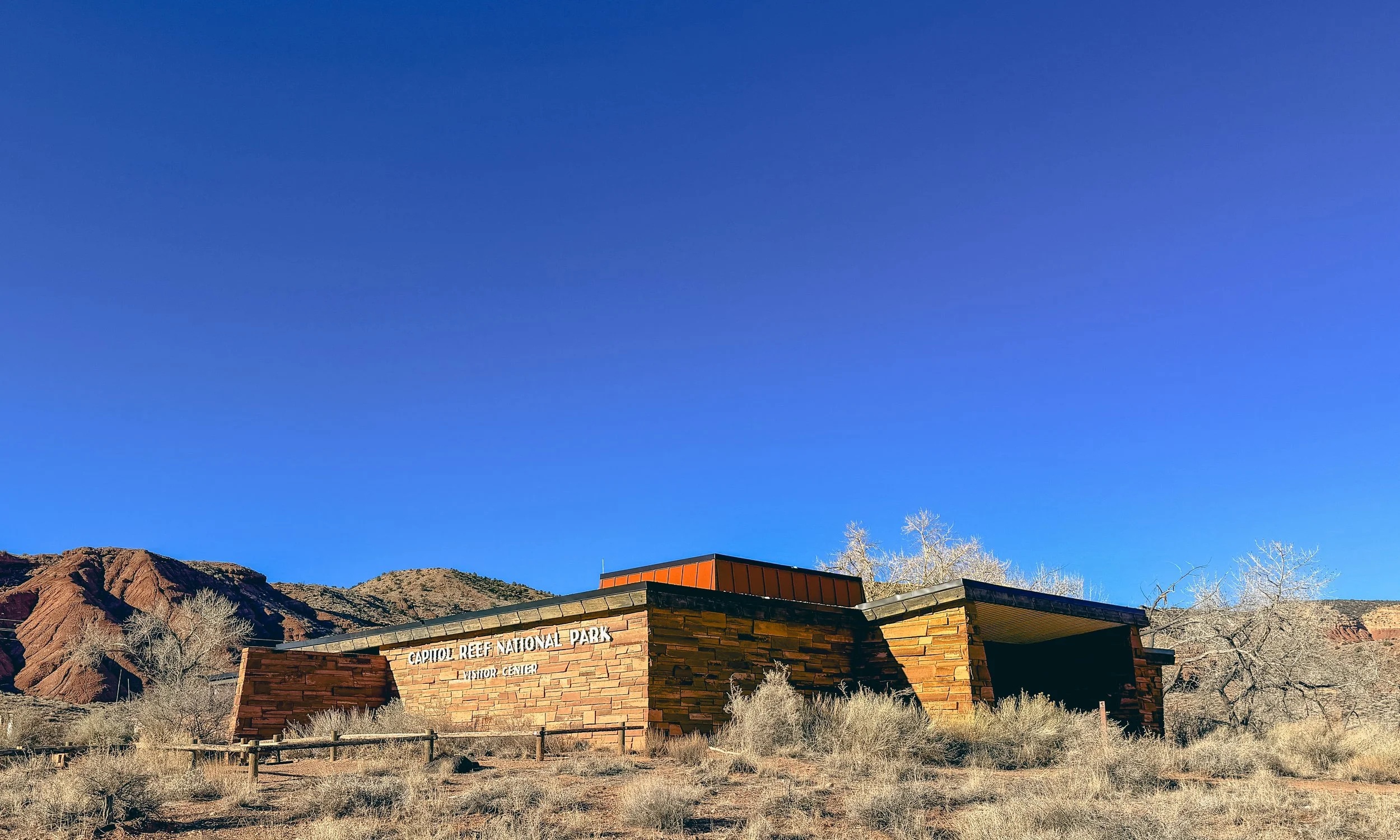
The visitor center at Capitol Reef National Park in the Fruita Historic District.
One of my favorite things to do is talk with a park ranger. Even when I’ve done research before arriving, rangers often know details or lesser-known spots that aren’t always obvious.
Another tradition I have is stopping at the gift shop area to get my National Parks passport book stamped.
If you haven’t started collecting them yet, it’s a fun way to track where you’ve been across the park system.
Read my guide: National Park Passport Stamps: How to Collect Them at Every National Park
Pro Tip: Use GuideAlong While Driving Through the Park
If you’re driving through Capitol Reef National Park, I recommend using the GuideAlong app.
It’s a GPS-based audio tour that explains the geology, history, and landmarks as you drive through the park. I use it in many national parks because it helps you understand what you’re seeing along the way.
2. The Fruita Historic District and Orchards
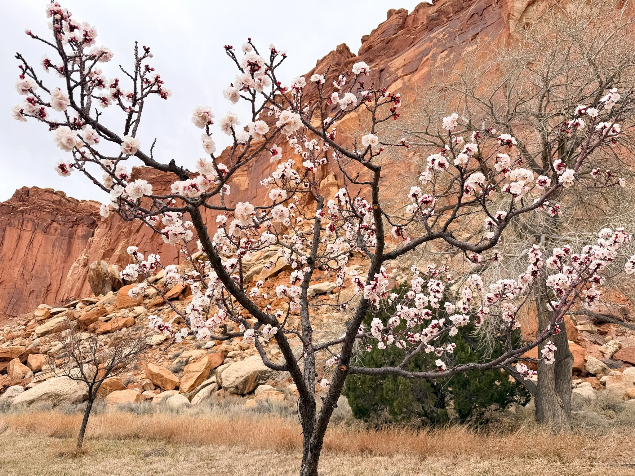
Apricot blossoms in the historic Fruita orchards of Capitol Reef National Park.
I thought Capitol Reef was going to be like many other national parks — geological formations and trails that lead to scenic features. I had no idea there was also a settler history here.
One of the most unique areas of Capitol Reef National Park is the Fruita Historic District.
In the late 1800s, settlers established a small farming community along the Fremont River. The river made farming possible in an otherwise dry desert valley.
Today the historic orchards are still maintained by the National Park Service. Apples, peaches, cherries, pears, apricots, and plums are still grown here, and during harvest season visitors can even pick fruit.
Driving through the orchards feels almost surreal. You’re surrounded by desert cliffs and red rock while looking at blooming fruit trees, often with deer grazing nearby — many of which were planted more than a century ago.
I also camped at the Fruita Campground, and the location ended up being one of my favorite camping spots in southern Utah. Being surrounded by orchards and towering red cliffs made it a memorable place to stay.
Pro Tip: March 14 is Pi Day, and the Gifford House Store & Museum in the Fruita Historic District opens at 9 a.m. selling fresh pies. I happened to be there the day after and picked up a strawberry rhubarb pie. If you're traveling through around that time of year, it’s something worth knowing.
3. Capitol Gorge and the Pioneer Register
One of the most interesting places in the park is Capitol Gorge.
The trail follows a narrow canyon wash between steep sandstone walls that once served as an important travel route through the region.
Along the canyon wall, you’ll find the Pioneer Register, where early settlers carved their names into the rock.
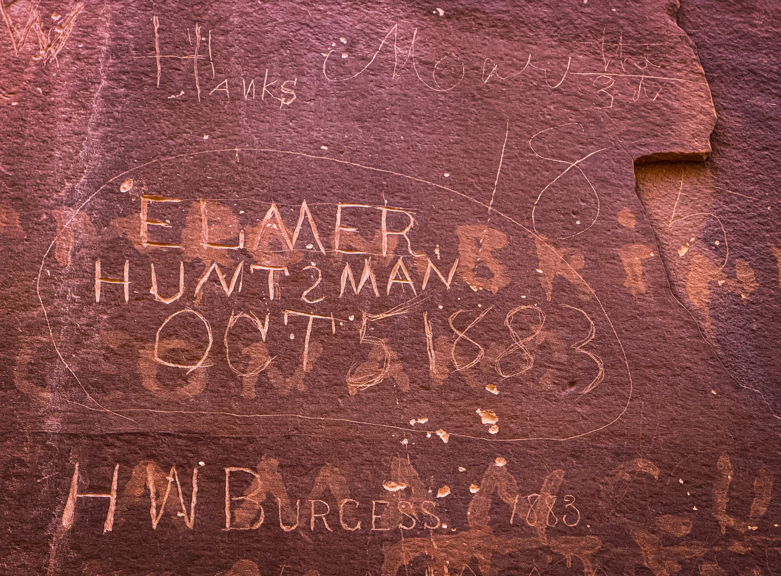
Historic pioneer names carved into sandstone at the Pioneer Register in Capitol Gorge.
I love history, and the idea that you’re hiking the same path pioneers once traveled makes the experience feel even more meaningful.
Many of the inscriptions date back to the late 1800s and early 1900s. Wagon travelers once passed through this gorge before modern roads existed in the area.
Seeing those names etched into the sandstone connects the modern park to the people who once moved through this landscape.
Watch my hike through Capitol Gorge: Coming soon.
4. Hickman Bridge Trail
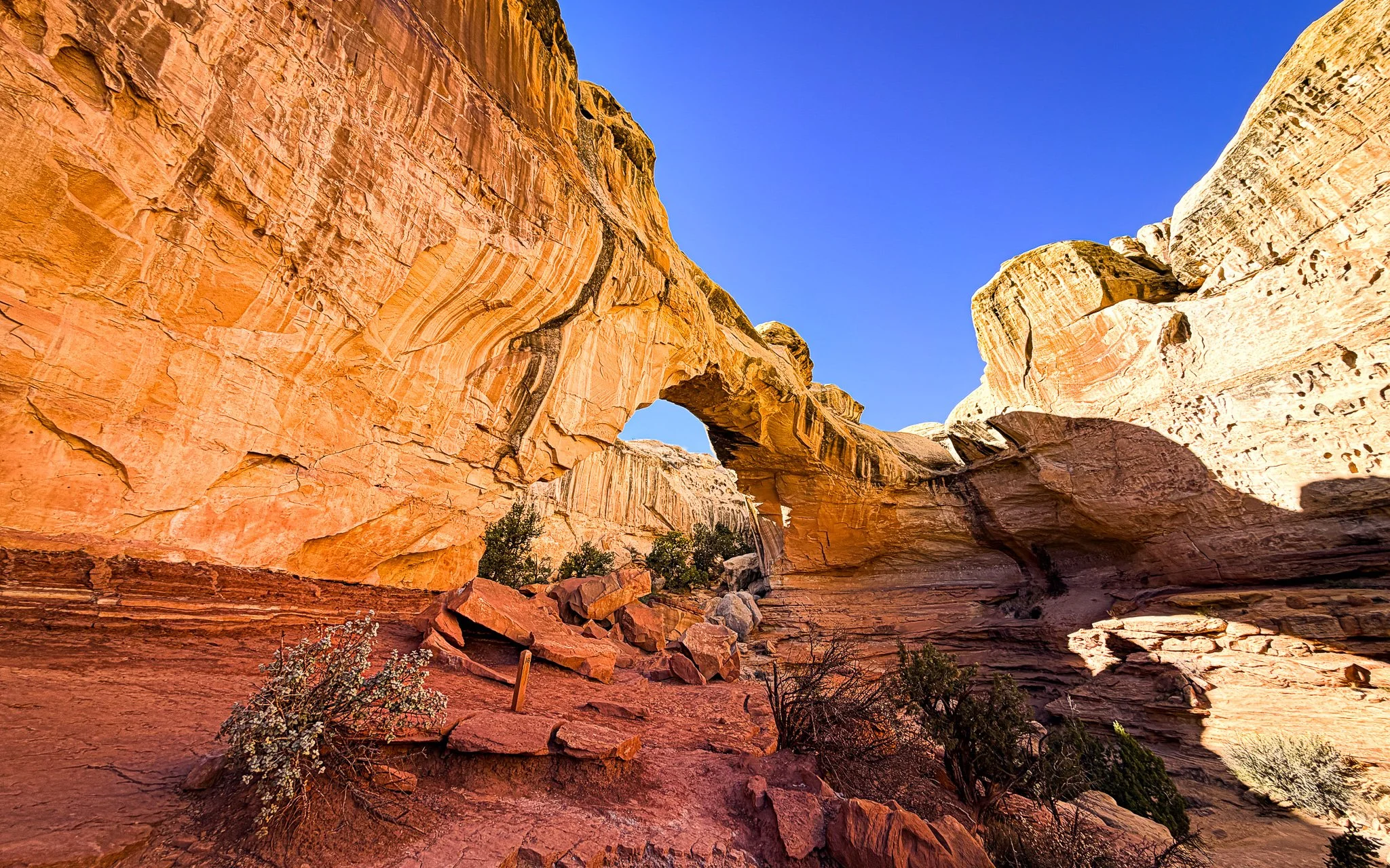
Hickman Bridge sandstone arch along the Hickman Bridge Trail in Capitol Reef National Park.
One of the most popular hikes in the park is the Hickman Bridge Trail.
This is a solid hike with a bit of a climb in the beginning. You will see alot of black rocks along the hike and these are from a volcano so you know. If you look to your right halfway through into a dry creek you will see two rock natural rock bridges made of sandstone along the way. Which is kind of ironic as you will soon look up and to your right and see the rather large Hickman Bridge.
The trail climbs steadily through sandstone terrain before reaching Hickman Bridge, a natural stone arch that spans across a small canyon.
Standing beneath the bridge really gives you a sense of the landscape's scale and how erosion has shaped the rock over time.
Along the hike, you can also see views of the Capitol Dome, the white sandstone formation that helped inspire the park’s name.
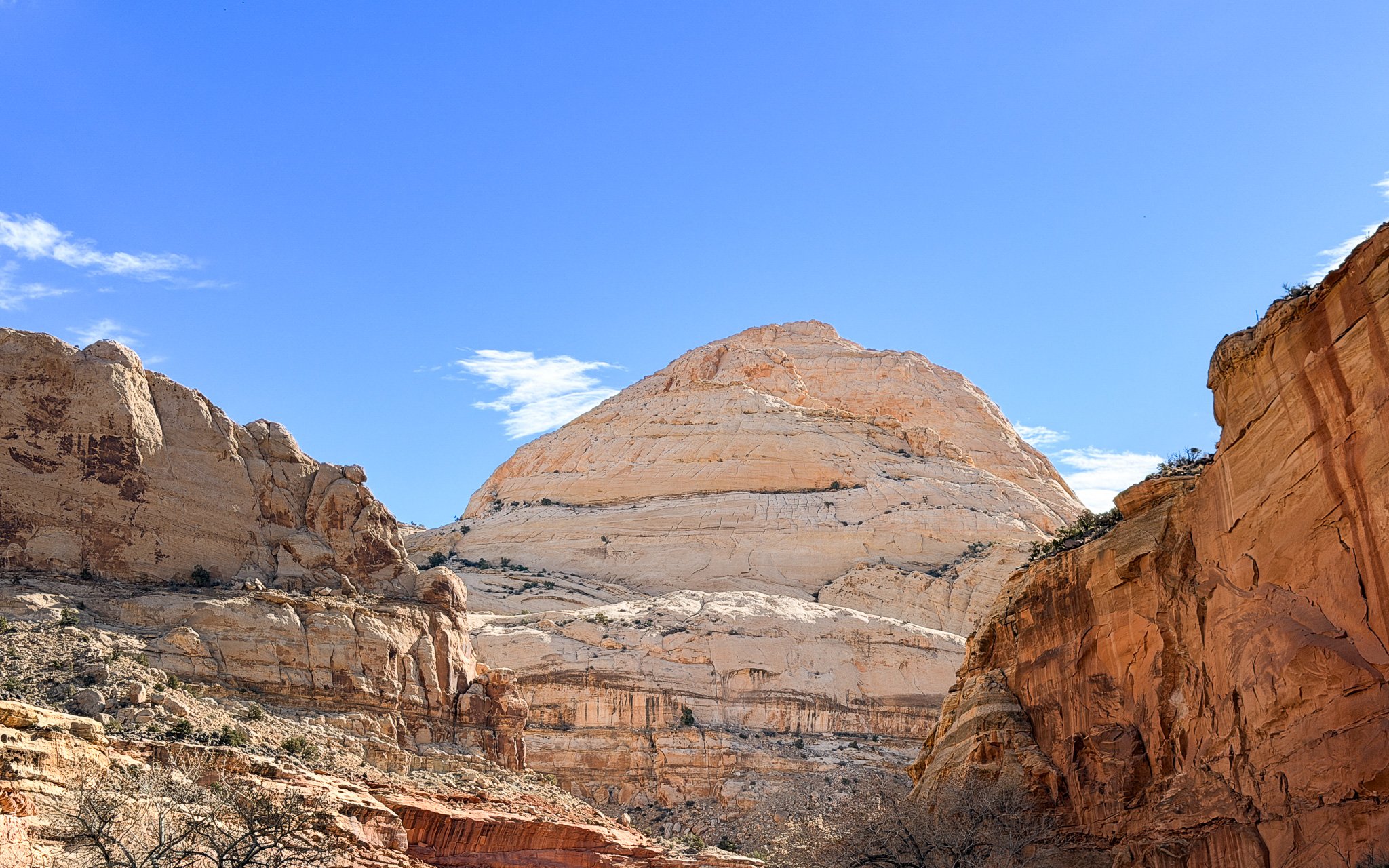
Capitol Dome rising above the Waterpocket Fold in Capitol Reef National Park.
Watch my hike to Hickman Bridge: Coming soon.
Pro Tip: When the trail reaches a fork, the park's suggested route is to go right. Most people I saw were heading left, but the better view is actually from the right.
5. Chimney Rock Trail in Capitol Reef National Park
I did the Chimney Rock Trail on my way back through Capitol Reef when I returned for Pie Day in the Fruita Historic District. I had planned to hike it on my first visit but ran out of time.
This hike ended up being one of the highlights of my trip.
Along the trail, I ran into a gentleman who has a cabin in the nearby town of Torrey and hikes this trail often. He showed me a few things I would have never noticed on my own.
The trail climbs gradually above the desert floor and opens up wide views of the surrounding landscape. From the trail, you can see the towering Chimney Rock formation rising dramatically from the desert below.
Near the beginning of the trail, he also showed me a large rock just off the path that contains visible dinosaur bone fragments embedded in the stone — another detail that would be easy to miss if you didn’t know where to look.
He also pointed out a short off-trail spot that photographers use to capture one of the best viewpoints of the formation. The view was incredible and not something I would have found on my own.
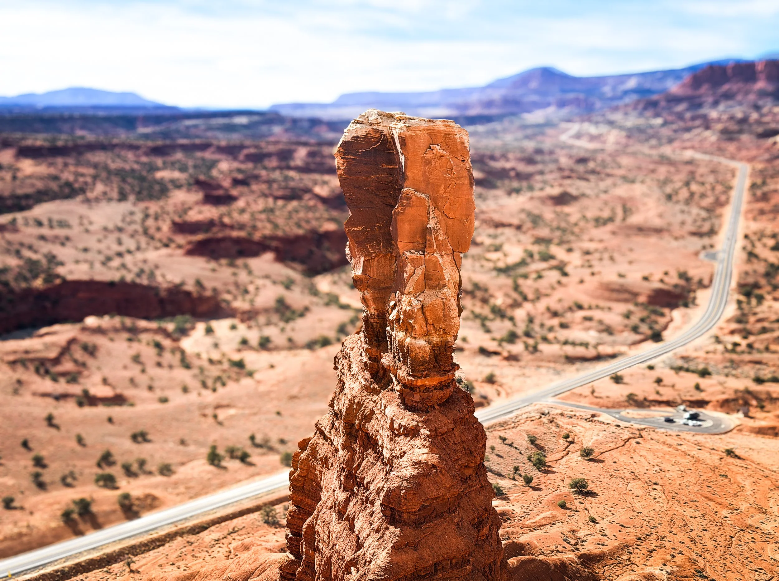
Chimney Rock formation rising above the desert landscape in Capitol Reef National Park.
What I liked most about this hike was the perspective it gives you of the Waterpocket Fold and the cliffs surrounding the Fruita area. As you gain elevation, the views open across the valley and the red rock landscape that makes this park so unique.
It’s not the most famous hike in the park, but it’s one that really helps you understand the scale of the terrain.
Watch my hike on Chimney Rock Trail: Coming soon.
Pro Tip: Locals often know the hidden details of places like this. If you run into someone who hikes the area regularly, it’s worth stopping to talk. They can be a fountain of knowledge.
Why Capitol Reef Became One of My Favorite Utah Parks
Capitol Reef surprised me.
It combines dramatic geology, quiet desert landscapes, pioneer history, and working orchards in a way that feels very different from the other Utah parks.
The park receives far fewer visitors than Zion National Park or Arches National Park, which means it often feels quieter and easier to explore without weaving in and out of people on the trails.
Between the Waterpocket Fold, the historic Fruita orchards, and the scenic desert hikes, it became one of the most interesting parks I visited in southern Utah.
To be honest, you can’t really go wrong with how you spend your time in Capitol Reef. These are simply the places I visited and enjoyed most.
More Utah National Park Guides
If you're exploring Utah’s parks, you might also enjoy:
Stargazing in Utah National Parks: Where to See the Darkest Skies
Capitol Reef National Park: Utah’s Most Overlooked Park
National Park Passport Stamps — How the Passport Book Works
Michele Underwood writes Overland Girl, where she shares firsthand travel experiences across the American West — from desert landscapes and national parks to small towns layered with history. Her work blends movement, place, and the stories that shape them.

Some posts may include affiliate links to products or services she uses on the road. If you choose to purchase through those links, she may earn a small commission at no additional cost to you. It helps support continued travel and storytelling. She only links to items she personally uses or would use herself.