
Capitol Reef National Park: Utah’s Most Overlooked Park
How a massive geological fold, pioneer orchards, and early settlers shaped one of Utah’s most fascinating national parks.
Words by Michele Underwood | Photos by Michele
Utah is famous for its national parks. Most visitors plan trips around Zion National Park, Bryce Canyon National Park, and Arches National Park.
But tucked between them sits one of the most interesting landscapes in the state: Capitol Reef National Park, a park with a deep frontier backstory.
It’s quieter, less visited, and tells a deeper story about geology, early settlers, and the orchards that still grow fruit in the desert today.
What makes Capitol Reef unusual is that its story isn’t just written in the cliffs and canyons. It’s also found in the small farming community that once existed here and the fruit orchards that still grow along the Fremont River.
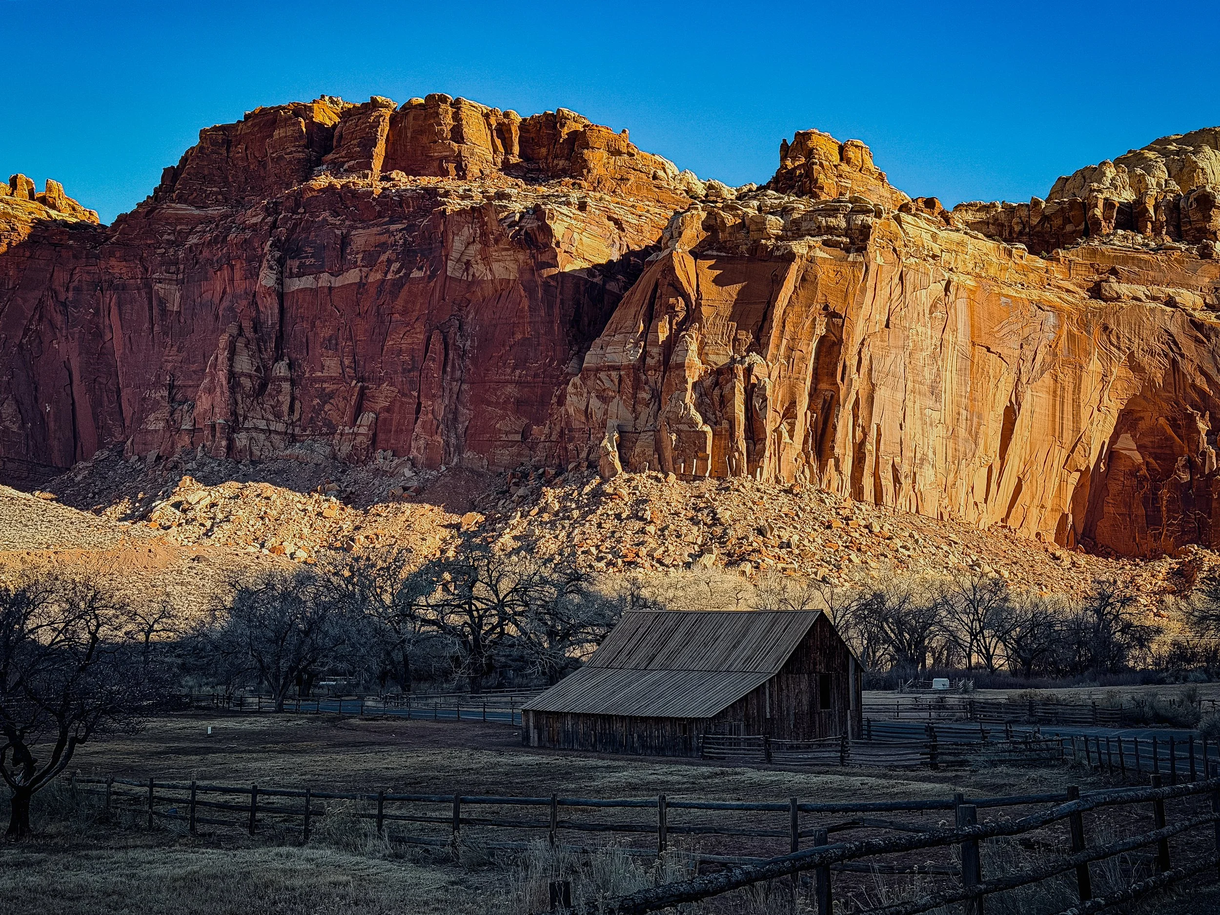
A historic barn in the Fruita district of Capitol Reef National Park with towering red cliffs of the Waterpocket Fold rising behind it.
Why It’s Called Capitol Reef
Capitol Reef gets its name from two different features in the landscape.
The “Capitol” part comes from the park’s white sandstone domes. Early visitors thought these formations resembled the dome of the United States Capitol building in Washington, D.C.
One of the best examples of this shape is the Capitol Dome, which rises above the surrounding desert cliffs.
The “Reef” part of the name refers to the long wall of rock that runs through the park. Early travelers compared this barrier to a coral reef in the ocean because it made travel across the desert difficult.
That barrier is part of the Waterpocket Fold, the massive geologic feature that defines Capitol Reef.
The fold gets its name from small depressions in the sandstone that collect rainwater. These natural pools are called waterpockets, and they can hold water long after storms pass through the desert.
The Geological Story of Capitol Reef
The Waterpocket Fold is one of the most unique geological features in the Southwest.
Stretching nearly 100 miles across southern Utah, the fold forms the backbone of Capitol Reef National Park.
Geologists describe it as a monocline, which is a type of fold where otherwise flat rock layers bend sharply in one direction.
Millions of years ago, tectonic forces deep within the Earth pushed part of the land upward. Instead of breaking apart, the rock layers bent into a giant wrinkle in the Earth’s crust.
Over time, wind, rain, and erosion carved into those tilted layers, creating the cliffs, domes, canyons, and ridges that shape the landscape today.
Driving through the park, you’re essentially traveling along the edge of this enormous fold.
How the Waterpocket Fold Formed
One of the easiest ways to understand the fold is to imagine the process step by step.
1. Layers Build Up
For millions of years, sediments like sand, mud, and silt were deposited across this region. These layers hardened into rock.
2. The Land Begins to Shift
Tectonic forces deep underground pushed one side of the land upward.
3. The Layers Bend
Instead of breaking apart, the rock layers folded into a giant wrinkle.
4. Erosion Begins
Wind, rain, and temperature changes slowly carved into the tilted rock layers.
5. The Landscape Appears
Over millions of years, cliffs, domes, and canyons formed — creating the landscape we see today.
Pro Tip: Use GuideAlong While Driving Through Capitol Reef
One thing I always recommend when visiting national parks is using GuideAlong.
It’s a self-guided audio tour that plays automatically as you drive through the park. Using GPS, the app knows where you are and begins explaining the landscape, geology, and history around you.
I use GuideAlong in every national park I visit because it teaches you things you would never know otherwise. For instance, in Capitol Reef, black rocks are scattered across parts of the landscape. When you get close to them, you notice they’re porous. They came from a volcanic area many miles away and were carried here long ago.
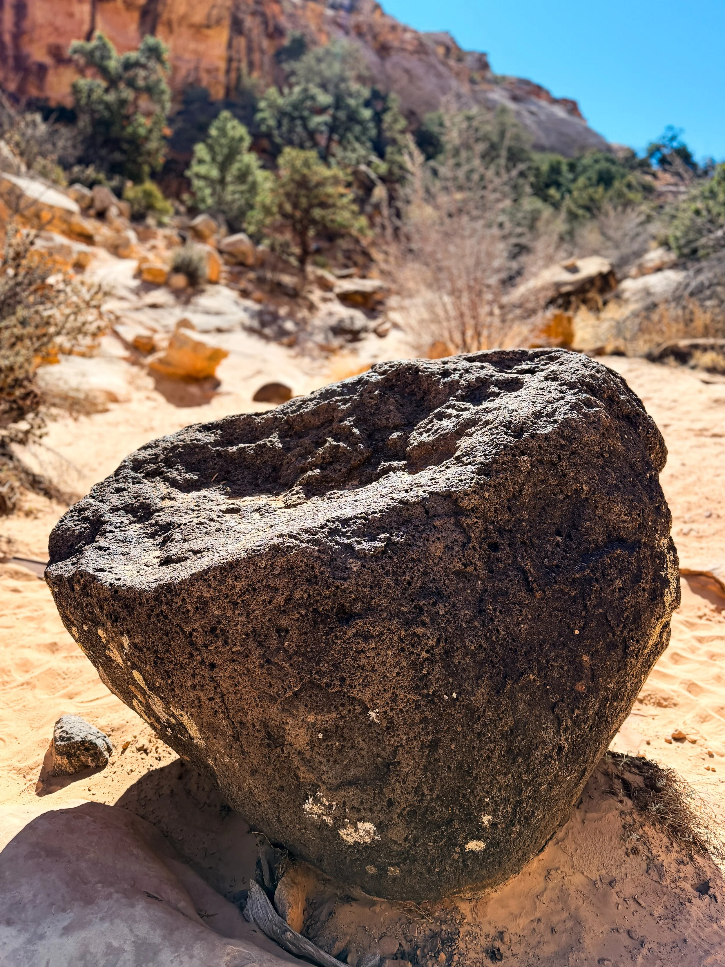
Porous volcanic rock found in Capitol Reef National Park. Some rocks in the area were carried here long ago and stand out against the surrounding sandstone landscape.
It’s details like that you would probably never know without a guide explaining what you’re seeing. It’s like having a park ranger in the car pointing out the landscape as you drive.
In Capitol Reef National Park, the tour does a great job explaining the Waterpocket Fold, the history of the Fruita settlers, and why the landscape looks the way it does.
The narrator is excellent and turns the drive through the park into a story rather than just a scenic road.
The Unexpected Orchards of Fruita
One of the most surprising things about Capitol Reef is the orchards.
In the late 1800s, settlers established a farming community along the Fremont River in what is now the Fruita Historic District.
The river made farming possible in an otherwise dry desert valley. Apples, peaches, pears, cherries, apricots, and plums were planted in orchards that still exist today.
The National Park Service now maintains these orchards, and during harvest seasons, visitors can even pick fruit. It is free if you eat the fruit there, but if you take fruit home, there is a small charge.
Many of the orchards are still named after the settler families who originally planted and farmed them in the Fruita community.
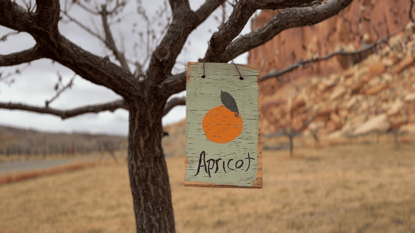
Apricot orchard sign in the Fruita Historic District, where fruit trees planted by early settlers still grow along the Fremont River.
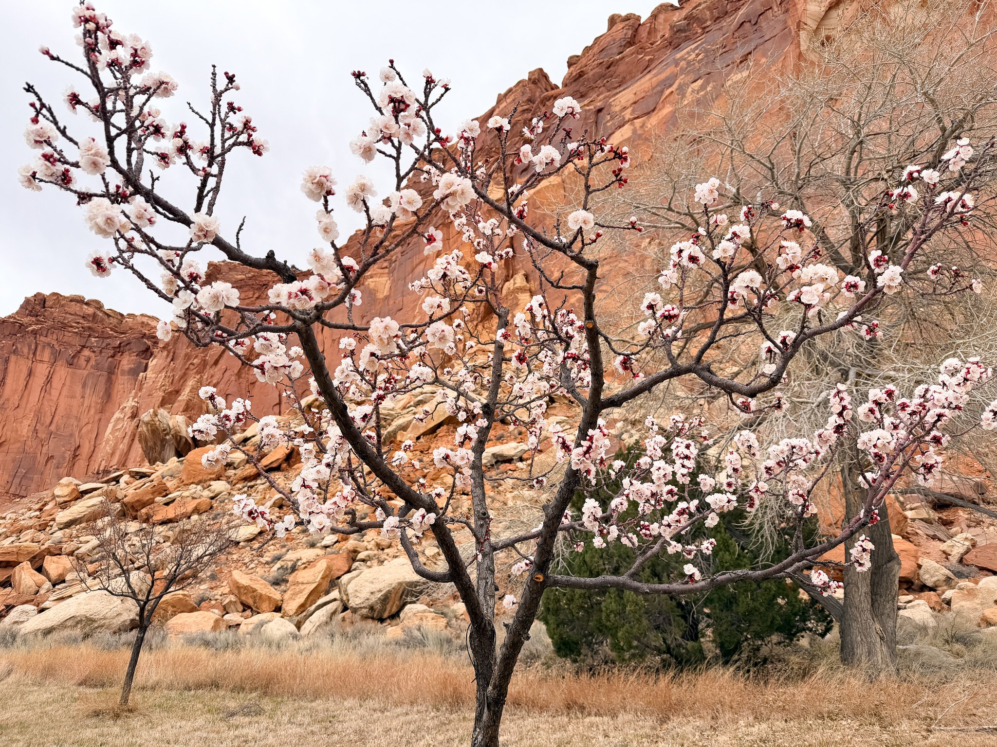
Apricot tree blossoms in the historic Fruita orchards of Capitol Reef National Park with the red cliffs of the Waterpocket Fold rising behind the trees.
Historic orchards in the Fruita area include:
Abbie Lu Orchard — cherries, apricots
Behunin Orchard — peaches, pears
Carrell Orchard — apples
Chesnut Orchard — apples, peaches
Cook Orchard — apples, pears
Gifford Orchard — apples, peaches, apricots, cherries, plums
Krueger Orchard — apples
Muley Twist Orchard — apples, peaches
Walking through the orchards feels almost surreal. One moment you’re surrounded by desert cliffs. The next time you’re standing beneath rows of fruit trees planted more than a century ago.
I also camped at the Fruita Campground and loved the location. Being surrounded by the orchards and cliffs made it one of the most memorable places I stayed during my time in southern Utah.
Hikes I Did in Capitol Reef
Several hikes around Capitol Reef National Park helped me understand the landscape better. Each one reveals a different part of the park’s story.
01 Hickman Bridge Trail
One of the most popular hikes in the park is the Hickman Bridge Trail.
The trail climbs through sandstone terrain before reaching Hickman Bridge, a natural stone arch that spans across a small canyon.
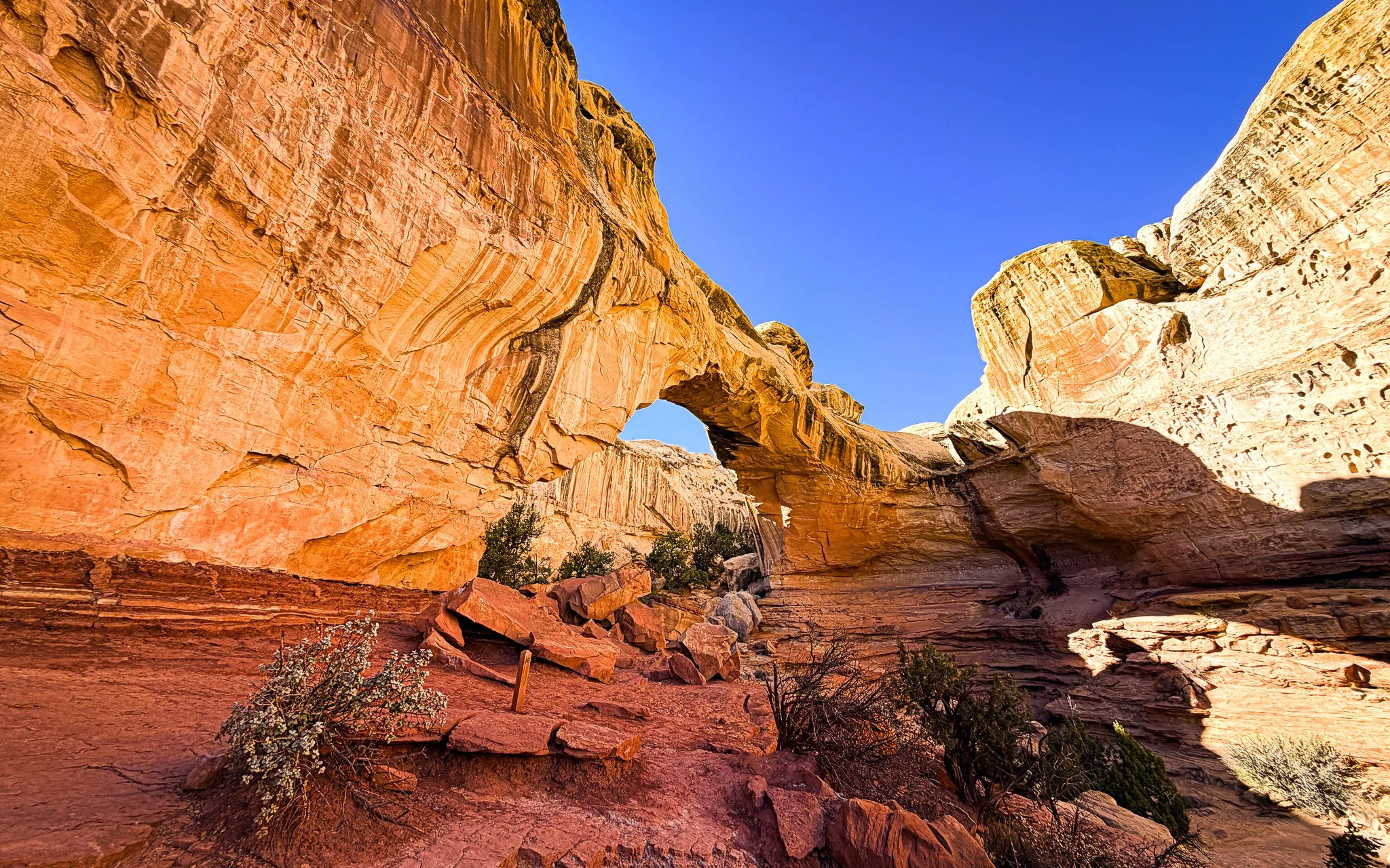
Hickman Bridge, a natural sandstone arch reached along the popular Hickman Bridge Trail in Capitol Reef National Park.
Along the hike, you can also see views of the Capitol Dome, the formation that helped inspire the park’s name.
Standing beneath the bridge gives you a sense of how erosion has shaped the landscape over time.
Photo caption:
Hickman Bridge in Capitol Reef National Park.
02. Grand Wash Trail
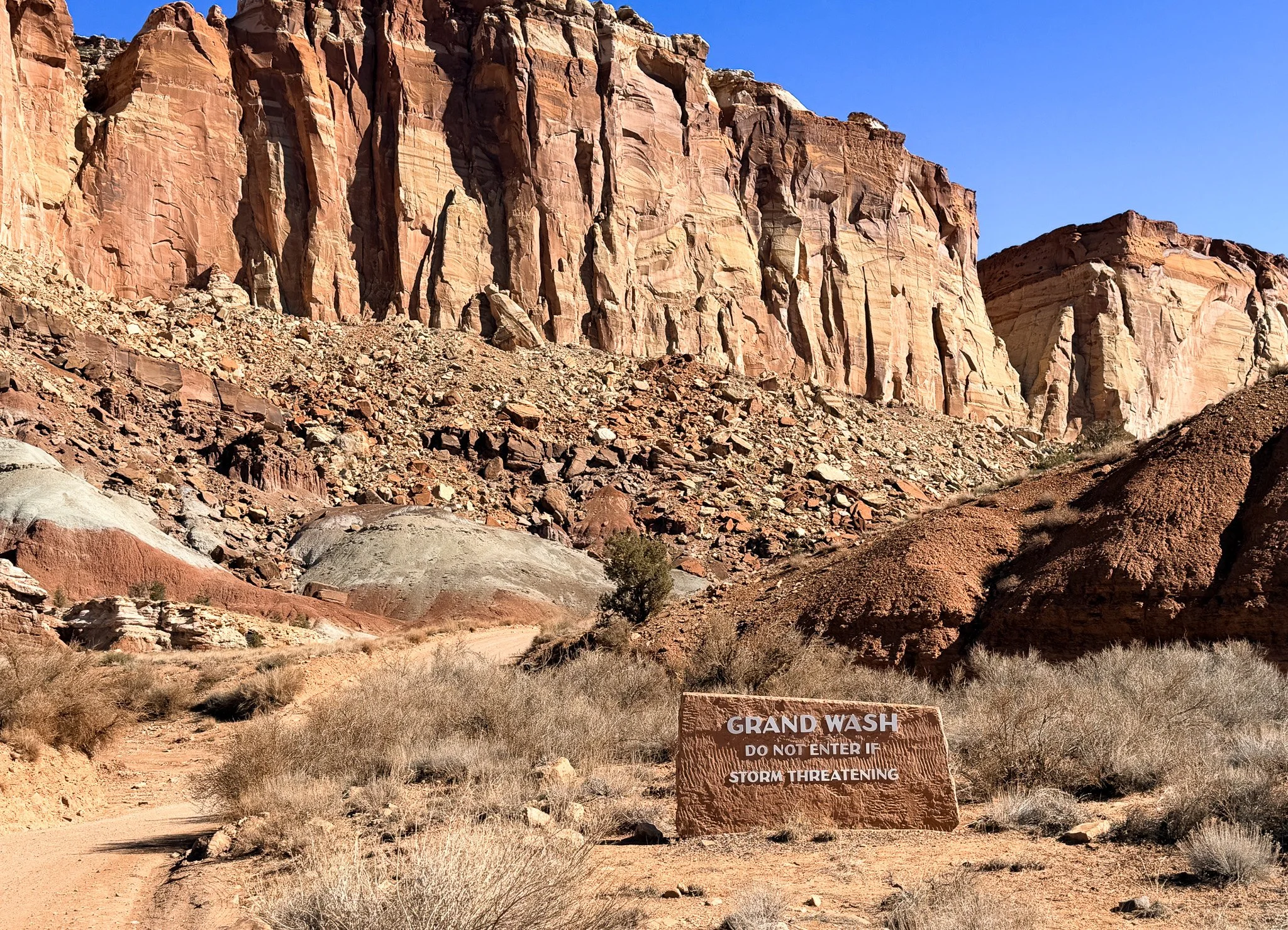
The entrance to Grand Wash Trail in Capitol Reef National Park where towering sandstone cliffs rise above the canyon floor.
Another hike I did was the Grand Wash Trail.
This trail follows a wide canyon wash between tall sandstone walls. In some places, the canyon narrows dramatically, and the cliffs rise straight up on both sides.
Walking through Grand Wash feels like moving through a natural corridor carved into the rock.
On the drive to the trailhead along Grand Wash Road, there’s also a reminder of another chapter of the region’s history. Off to the side of the dirt road are two small cave openings that have been boarded up. Behind one of the boarded entrances, you can see a warning sign with the atomic symbol through the gaps. It’s a quiet reminder of the uranium mining activity that once took place in parts of southern Utah.
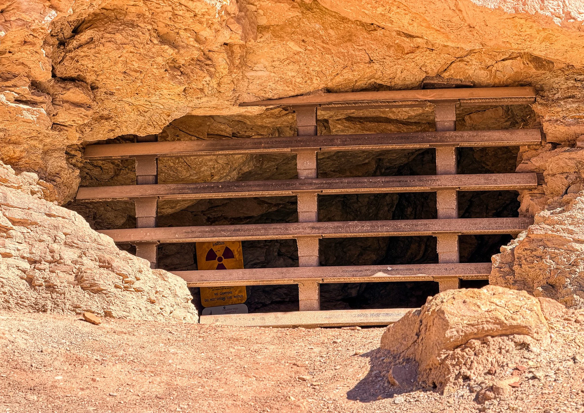
A boarded uranium mine opening along Grand Wash Road in Capitol Reef National Park with a radiation warning sign visible behind the metal bars.
03. Capitol Gorge Trail
One of the most interesting hikes in the park is the Capitol Gorge Trail.
The trail follows a narrow canyon wash between steep sandstone walls.
Along the canyon wall, you’ll find what’s known as the Pioneer Register, where early settlers carved their names into the rock. Many of the inscriptions date back to the late 1800s and early 1900s.
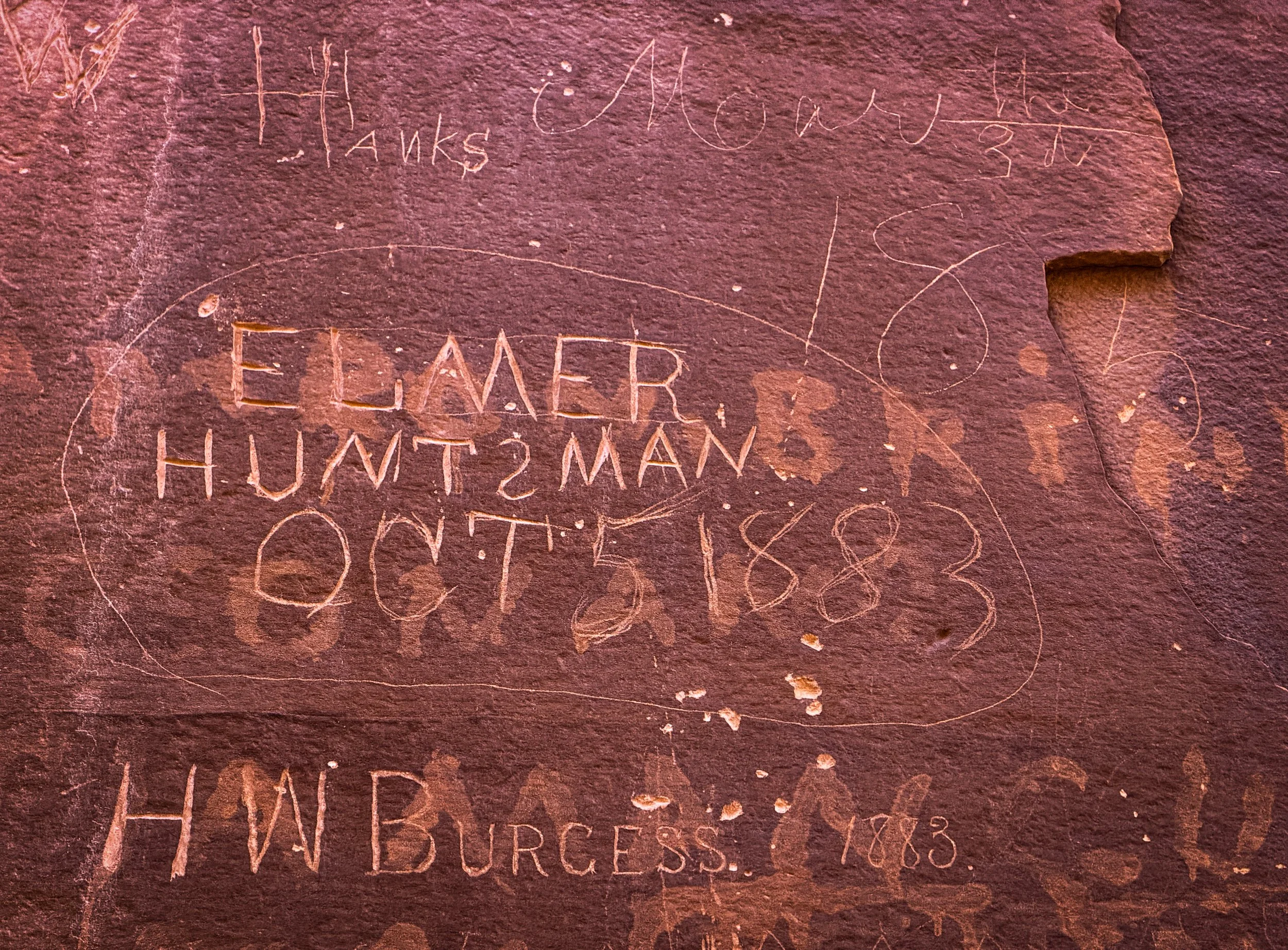
Names carved into the sandstone at the Pioneer Register along Capitol Gorge Trail, where early settlers left their mark in the late 1800s.
Before roads were built through the park, this gorge served as an important travel route through the region.
Seeing those names etched into the sandstone connects the modern park with the people who once traveled through this landscape.
Why Capitol Reef Feels Different
Compared to the other parks in southern Utah, Capitol Reef receives far fewer visitors.
That quieter atmosphere is part of what makes it special. The park feels more remote and easier to explore at a slower pace. The feel of the settlers also makes it special. You can get a feel for their homestead and way of life. That is probably what touched me the most about the park. This bit separates it from the Utah 5 for sure.
It’s also a place where geology and human history intersect. The Waterpocket Fold rises across the desert while orchards planted more than a century ago still grow along the Fremont River.
For travelers willing to venture beyond the more famous parks, Capitol Reef offers a different kind of experience.
One that feels quieter, older, and deeply connected to the land.
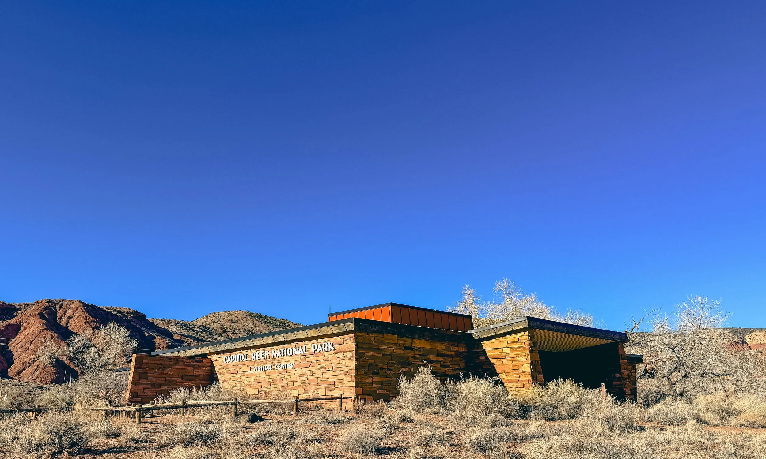
Capitol Reef National Park visitor center in the Fruita district, surrounded by the red rock landscape of southern Utah.
National Parks Passport Stamps
Get a National Parks Passport Stamp Book and bring it with you when you visit parks and monuments. Visitor centers usually have a stamp station where you can mark the places you’ve been.
At the visitor center in Capitol Reef National Park, there’s a passport stamp station where you can record your visit. I stamped my book while I was there.
The National Parks Passport Stamp Book is a fun way to keep track of the parks and monuments you visit. Each location has its own ink stamp with the date and park name.
The books are great for both children and adults, though I usually see more adults than kids standing at the stamp desk.
I keep my passport book in the van so I can stamp it anytime I stop at a visitor center.
Final Thoughts
Capitol Reef is one of those parks that becomes more interesting the more you understand it.
At first it appears to be another beautiful desert landscape. But as you drive deeper into the park, you begin to notice the geological features, the architectural remnants of the early settlers, and eventually the orchards that still grow fruit along the Fremont River.
That’s why Capitol Reef National Park is often considered one of Utah’s most overlooked national parks.
It’s not just beautiful.
It has a story.
Explore More Adventures in Utah
Stargazing in Utah National Parks: Where to See the Darkest Skies
Michele Underwood writes Overland Girl, where she shares firsthand travel experiences across the American West — from desert landscapes and national parks to small towns layered with history. Her work blends movement, place, and the stories that shape them.

Some posts may include affiliate links to products or services she uses on the road. If you choose to purchase through those links, she may earn a small commission at no additional cost to you. It helps support continued travel and storytelling. She only links to items she personally uses or would use herself.