The Mining History Along the Million Dollar Highway: Ouray to Silverton
The mines, ghost towns, and mining history can still be seen in Colorado's San Juan Mountains
Words by Michele Underwood | Photos by Michele & Public Domain Archives
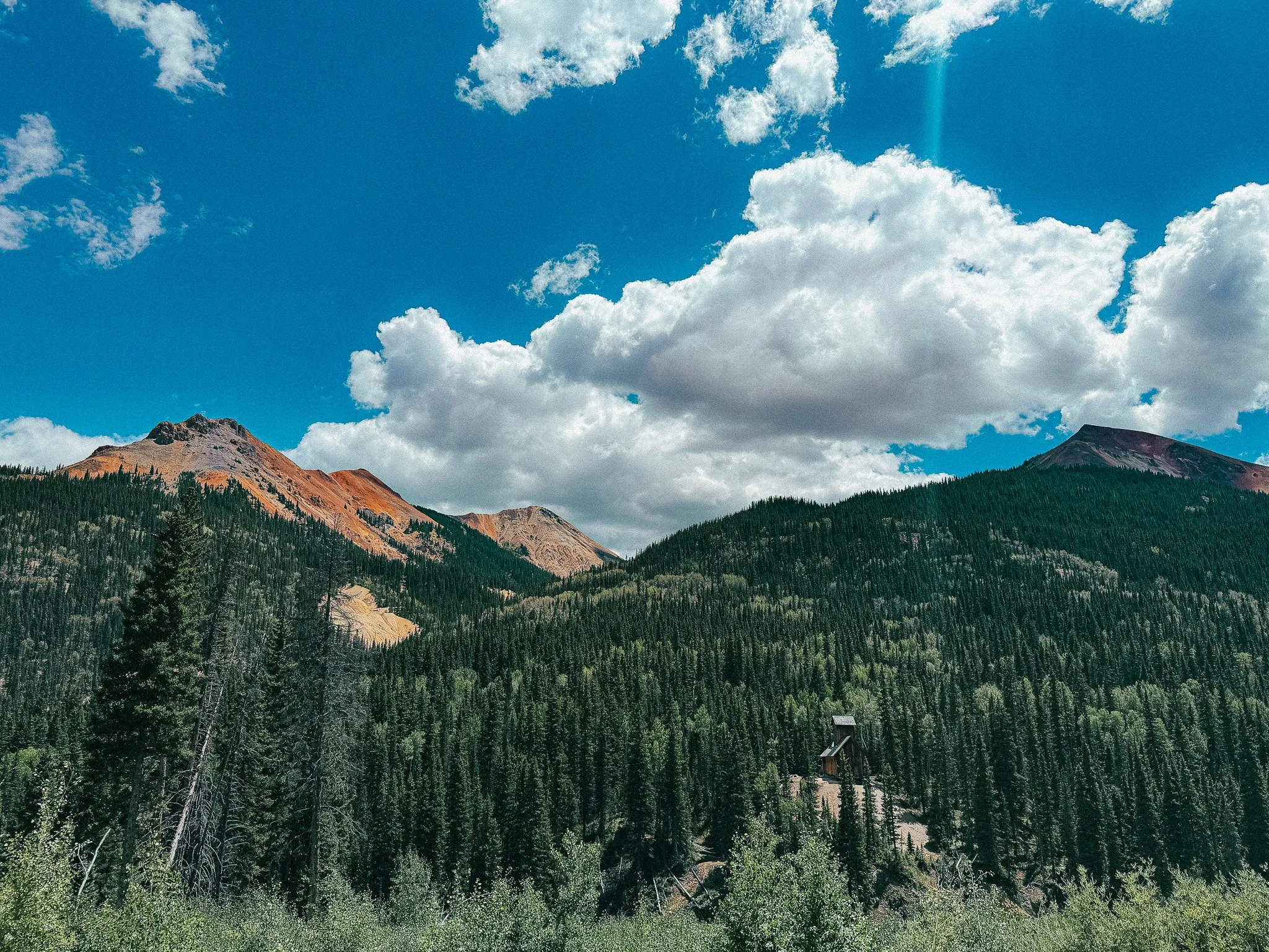
An old mining structure sits below the mineral-colored mountains of the Red Mountain Mining District.
When I drove the Million Dollar Highway from Ouray to Silverton, what caught my attention most wasn't the steep drop-offs or lack of guardrails. It was everything left behind from mining.
Old mine buildings sit against the mountainsides. Abandoned structures appear around Ironton and Red Mountain Pass. Piles of rock spill down slopes where miners once pulled valuable ore from these mountains.
By the time I reached Silverton, I wanted to know how it all connected.
It turns out the mining ruins you see along the Million Dollar Highway aren't a collection of unrelated abandoned mines. They are pieces of a much larger mining story that transformed this part of the San Juan Mountains during the late 1800s. And Silverton is a big part of that story.
Why There Was So Much Mining Here
People knew there were valuable minerals in the San Juan Mountains before the major mining boom began, but access to the area changed significantly in the 1870s. After the Brunot Agreement of 1873, large portions of the San Juans were opened to mineral development by non-Indigenous prospectors, and they poured in looking primarily for gold and silver.
The terrain made it difficult. These are high, steep mountains with long winters and heavy snowfall, and many mines were established at elevations where getting workers and supplies to the site was a challenge on its own. But the potential value underground kept people coming — mining camps appeared, roads were built, towns grew. Some survived. Many didn't.
Ouray was founded during that boom and quickly became an important center for the surrounding mining districts — a natural place for miners to get supplies before heading farther into the mountains. When I drove south out of Ouray, I was essentially following the same direction miners and supply wagons would have traveled to reach the mining areas around Red Mountain. The difference is difficult to imagine. I was driving my Sprinter on a paved highway. They were moving people, equipment, food, and ore through some of the most difficult mountain terrain in Colorado.
That same need to move people, supplies, and ore through the mountains is what eventually created the route that became the Million Dollar Highway itself — I wrote more about that separately in The History of the Million Dollar Highway: Mining, Toll Roads & the Road Through the San Juans.
Ironton and the Red Mountain Mining District
One of the communities that grew up along that route was Ironton, which developed during the mining boom of the 1880s and became an important settlement for the mines in the surrounding area. At its height, hundreds of people lived there. Today, the setting feels completely different — only remnants of the town remain, and the forest has reclaimed much of the landscape. It's difficult to picture Ironton as an active mining community now, but people built a real one here. They lived through San Juan winters, raised families, operated businesses.
As you continue toward Red Mountain Pass, you enter what became one of the most productive mining areas in the range. Prospectors began making significant discoveries around Red Mountain in the early 1880s — the geology here held deposits of silver, gold, lead, copper and zinc, and once valuable ore was found, claims multiplied across the mountains. Mines opened at elevations that seem almost impossible when you look up at them from the road today.
The single most important discovery in the district was the Yankee Girl Mine, found in 1882 and known for extremely rich silver ore. Its success helped fuel interest in the whole Red Mountain area, and its headframe — the original was destroyed by fire in 1897, but its replacement survived — is still one of the most recognizable mining structures standing along the highway today. This was one of the things I loved about learning the history after my drive: I'd been looking at old structures scattered across the mountains without knowing what they were. Once you know the Yankee Girl story, that structure isn't just another abandoned mine. It represents the discovery that helped fuel an entire mining boom.
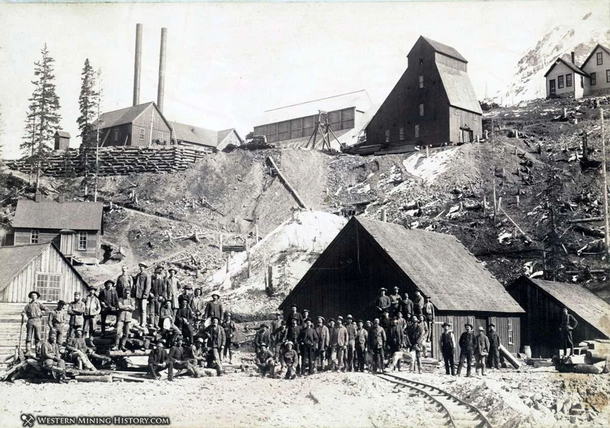
The Yankee Girl Mine headframe still stands below the mineral-colored mountains of the Red Mountain Mining District.
Mines need workers, and workers need somewhere to live, which is what led to settlements like Red Mountain Town. During the height of the boom, thousands of people lived throughout the district, and Red Mountain Town had hotels, stores, saloons, newspapers, schools, and a post office — a functioning community at more than 11,000 feet, where winters are long and avalanches are simply part of life. Looking at this area today, that's almost hard to comprehend. Eventually, fires, declining mining activity, and changing economics took their toll. Red Mountain Town disappeared. The mountains remained.
One thing I noticed while driving through was how much disturbed rock still sits on the mountainsides — piles of waste rock and tailings left behind as miners dug through the mountain and processed ore. More than a century later, they're still visible, and once you know what you're looking at, they make it much easier to spot where mining happened even when the original buildings are long gone.
The colors around Red Mountain Pass are part of the same story. Those rusty reds, oranges, and yellows come from iron-bearing minerals in the rock oxidizing when exposed to oxygen and water — and the same complex geology that produced those colors also produced the mineral deposits that attracted prospectors here in the first place. I liked the landscape before I knew that. Knowing the geology made it even more interesting.
How Silverton Became the Center of It All
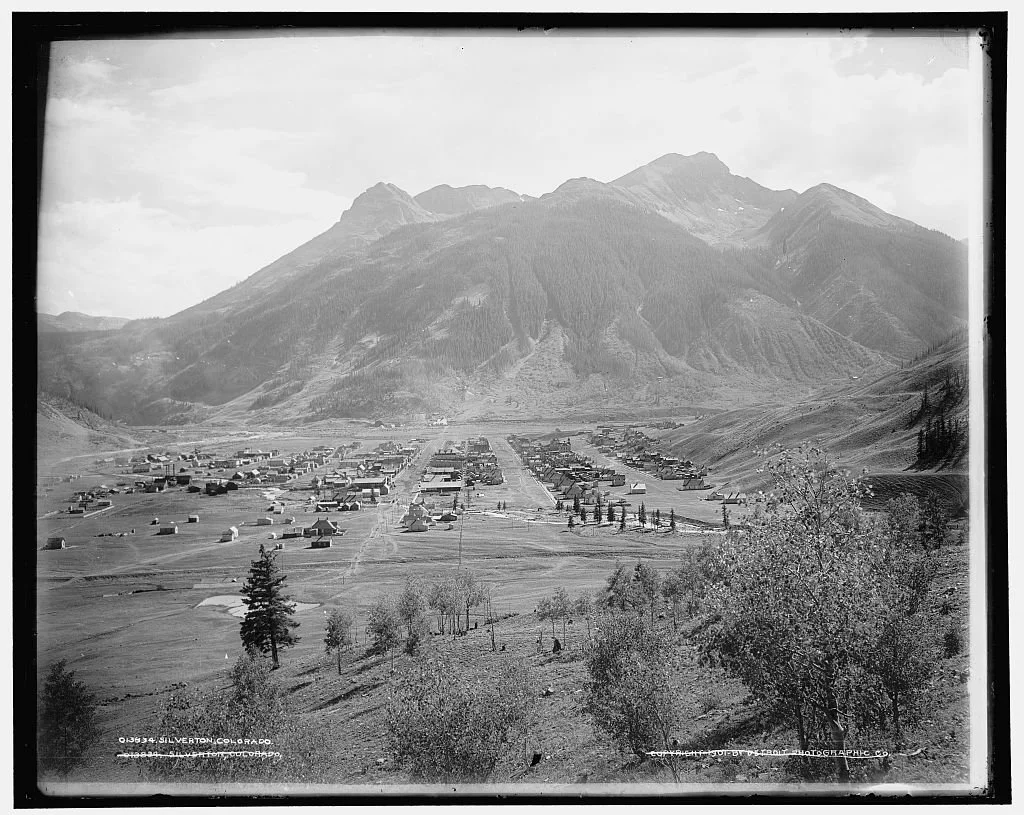
Silverton during its mining era, when the town served as a center for mines throughout the surrounding San Juan Mountains.
Mining didn't stop at Red Mountain Pass. As you descend toward Silverton, you're entering another landscape shaped heavily by mining — operations ranging from small claims to major industrial mines spread throughout the surrounding mountains, with roads and rail lines eventually connecting many of them to town. And unlike many of the settlements farther up in the mountains, Silverton survived.
Silverton exists because of mining. Established in the 1870s in the Animas River valley, its location was simply more practical than trying to build every service high beside the mines — miners could live in Silverton, businesses could supply them, and ore could be brought down for transportation and processing. Then the railroad arrived. The Denver & Rio Grande Railroad reached Silverton from Durango in 1882, the same year the Yankee Girl Mine was discovered, and that connection changed what was possible — instead of relying entirely on wagons over mountain roads, Silverton now had a rail link to Durango and markets beyond the San Juans. Mining expanded farther into the mountains around town.
The railroad didn't stop mattering once it reached Silverton, either. Additional narrow-gauge lines were built from there into the surrounding mining districts, following valleys and climbing toward areas that needed better transportation — not for tourism, but for ore, since railroads could move far more material than wagons ever could. Today, the Durango & Silverton Narrow Gauge Railroad is one of the most recognizable attractions in this part of Colorado, and its origins trace directly back to that same mining transportation system.
Why Some Towns Disappeared and Silverton Didn't
Mining towns could grow incredibly quickly, and they could disappear just as quickly. A town's survival often depended entirely on the mines around it — when ore ran out, metal prices dropped, or operating a mine became too expensive, jobs disappeared and people followed. That's what happened throughout the Red Mountain Mining District. Ironton faded. Red Mountain Town disappeared. Other camps vanished almost completely.
Silverton had an advantage many of the smaller settlements didn't: it was never built around just one mine. It served a whole network of mines spread throughout the surrounding mountains, with businesses, transportation connections, and eventually a railroad tying it to communities beyond the immediate mining district. Mining remained central to Silverton for generations, but the town was able to keep going as individual mines opened and closed around it. Over time, tourism became increasingly important too — the railroad that once supported mining became an attraction in its own right, and the mountains that prospectors came to dig into became the reason other people started coming just to see them. Silverton never completely lost its mining identity. You can still see it everywhere.
The Mining History Is Still Right There
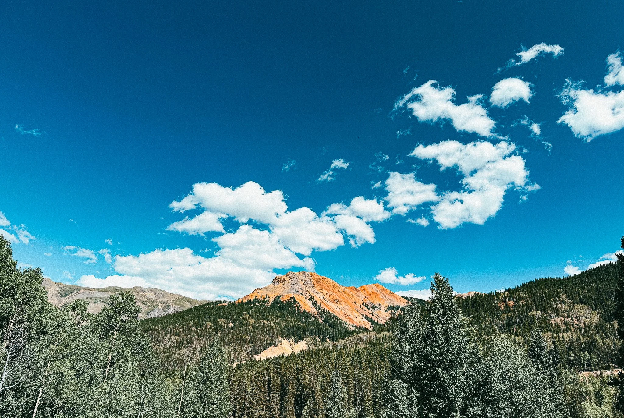
The mineral-rich colors of Red Mountain stand out above the forests along the Million Dollar Highway.
That's what I kept thinking about after driving from Ouray to Silverton. So much of the history is still sitting in the landscape — you don't have to visit a museum to see any of it. There are mine structures on the mountainsides. Tailings and waste-rock piles mark places where people dug into the mountain. Remnants of Ironton sit near the road. The Yankee Girl headframe still stands in the Red Mountain Mining District. Then you arrive in Silverton, and suddenly all those pieces begin to connect — the mines created communities, the communities needed roads, the mines needed transportation, railroads followed, and Silverton grew into the center of it all.
If you're planning to drive it yourself, I also wrote about what the road is actually like — the exposed sections, and my experience driving it in both directions.
Today, you can drive through in a couple of hours and see what remains. But when I look at those old mines now, I don't see abandoned buildings scattered randomly across a pretty Colorado landscape. I see pieces of the story that built this part of the San Juan Mountains.
I write Overland Girl, where I share firsthand travel experiences across the American West — from desert landscapes and national parks to small towns layered with history. My work blends movement, place, and the stories that shape them.Some posts may include affiliate links to products or services I use on the road. If you choose to purchase through those links, I may earn a small commission at no additional cost to you. It helps support continued travel and storytelling. I only link to items I personally use or would use myself.