The History of the Million Dollar Highway: Mining, Toll Roads & the Road Through the San Juans
How mining, Otto Mears, and the need to move ore through the San Juan Mountains helped create one of Colorado’s most famous roads.
Words by Michele Underwood | Photos by Michele, Alex Moliski & Public Domain Archives
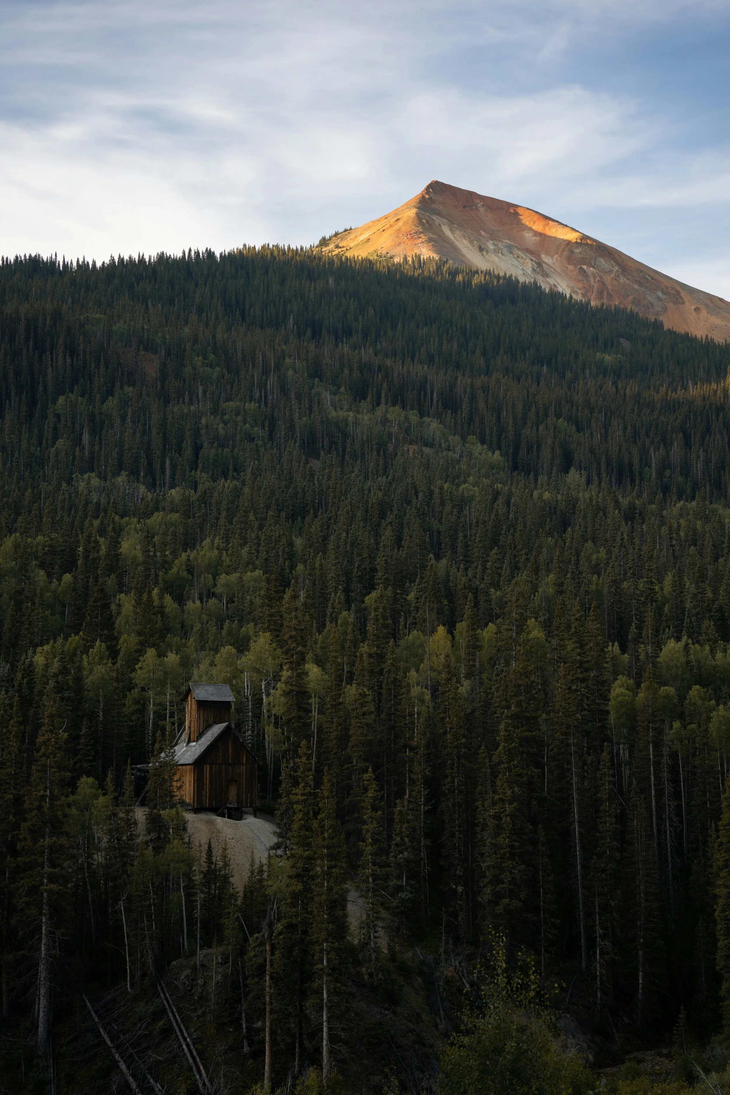
An old mining structure sits below the mineral-stained mountains of Colorado's Red Mountain Mining District. Photo by Alex Moliski.
When I drove the Million Dollar Highway between Ouray and Silverton, I mostly focused on the road ahead, the drop-offs, and the incredible scenery.
But you also can't drive through this part of Colorado without noticing the remains of its mining history. Old structures sit on the mountainsides, mine entrances appear along the road, and Red Mountain itself looks like a place where something happened.
That made me want to know how this road ended up here in the first place.
The answer has a lot to do with mining.
Long before tourists started driving the Million Dollar Highway for the views, people were trying to figure out how to move miners, supplies, and ore through some of the San Juan Mountains' most difficult terrain.
Before the Million Dollar Highway
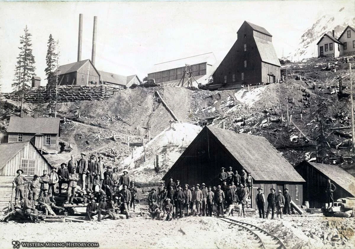
Miners gathered outside a mine in Colorado's Red Mountain Mining District during the area's mining boom.
The road we now know as the Million Dollar Highway didn't begin as a scenic drive.
Mining brought people into the San Juan Mountains in large numbers during the second half of the 1800s. Prospectors were working throughout the region by the 1870s, and mining around Red Mountain took off after the discovery of the Yankee Girl Mine in 1882.
Getting into these mountains was another matter.
Silverton sits surrounded by high peaks, and early miners had to move everything from food and equipment to ore through extremely rugged terrain. Before better roads were built, pack animals were one of the few ways to move through the mountains.
As the mines grew, that wasn't enough.
Mining Created the Need for a Road
By the late 1870s and early 1880s, mining activity around Ouray, Silverton and Red Mountain was creating a serious transportation problem.
Ore had to get out.
Heavy equipment and supplies had to get in.
In 1878, the Ouray-San Juan Wagon Road Company began building south from Ouray toward Red Mountain and Poughkeepsie Gulch. Ouray County eventually took over the project and spent about $42,000 completing the road.
But one of the names that would become most closely associated with transportation through the San Juans was Otto Mears.
Who Was Otto Mears?
Otto Mears was a road and railroad builder who became known as the "Pathfinder of the San Juans."
He built transportation routes throughout southwestern Colorado at a time when doing so meant carving roads into mountainsides with equipment that was a long way from what road crews have today.
Mears provided additional money to complete the route toward Red Mountain and operated it as a toll road for several years. According to a 1927 account published by the Colorado Highway Department, travelers paid $5 for a team and wagon, with additional charges for extra horses. A saddle animal cost $1.
Imagine paying a toll and then taking a horse-drawn wagon over Red Mountain Pass.
Driving it in my van suddenly doesn't seem quite as adventurous.
The Red Mountain Mining Boom
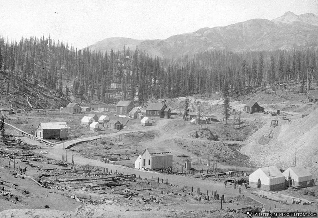
Red Mountain in 1892, when mining communities filled an area that looks very different along the Million Dollar Highway today.
The road became increasingly important as the Red Mountain Mining District exploded.
The discovery of the Yankee Girl Mine in 1882 helped trigger a major mining boom, and mines and settlements began appearing throughout the mountains between Ouray and Silverton.
They pulled gold, silver, and other metals from these mountains, and transportation routes followed the mines.
That's one of the things I find so interesting about driving the Million Dollar Highway today. Some of the scenery that looks wild and remote wasn't always quiet.
There were mines, mills, rail lines, wagon roads, and entire communities scattered through these mountains.
Today, you can still see pieces of that history from the highway.
I went deeper into the mines, mining towns, and old structures you can still see in The Mining History Along the Million Dollar Highway: Ouray to Silverton.
Red Mountain Was Once Full of Mining Towns
It's difficult to picture now, but the area around Red Mountain Pass once supported busy mining communities.
People weren't coming up here for the views. They were living and working at elevations around 11,000 feet because valuable ore had been discovered in the surrounding mountains.
The roads throughout this region were built largely to serve those mines. Even many of the rough backcountry roads that people now explore by 4x4 on the nearby Alpine Loop trace routes originally used by miners hauling ore toward Silverton, Ouray and Lake City.
When you're driving through today, the abandoned structures scattered across the mountains make a lot more sense once you understand what was happening here in the late 1800s.
From Toll Road to Public Road
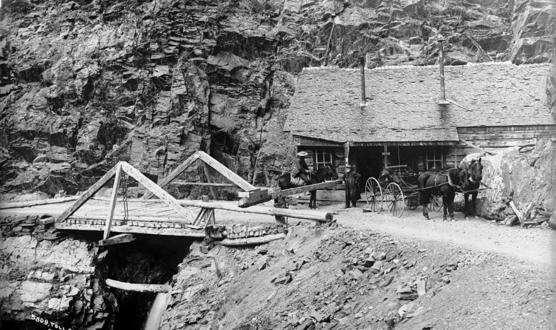
The Otto Mears toll road through the San Juan Mountains, an early route that helped shape today's Million Dollar Highway.
The road didn't remain privately operated forever.
By 1887, the county and state had officially taken over the route.
Transportation kept changing as railroads expanded through the San Juans, but the old wagon and toll roads established routes that shaped how people moved through these mountains for decades.
Eventually, automobiles changed things again.
And that's when the road started becoming something closer to the Million Dollar Highway we know today.
Building the Million Dollar Highway
Colorado began improving the route for automobile travel in the early 20th century.
According to the Colorado Department of Transportation's historical timeline, the state highway department completed the Million Dollar Highway in 1924.
A Colorado Highway Department publication from 1927 described the approximately 24-mile section between Ouray and Silverton as one of the most expensive pieces of highway in the country.
Think about where they were building it.
The road had to climb from Ouray toward Red Mountain Pass, cross terrain above 11,000 feet and descend toward Silverton through mountains that are steep, rocky and prone to snow, avalanches and rockfall.
Even with modern equipment, maintaining this road isn't easy.
Building it a century ago is pretty remarkable.
Why Is It Called the Million Dollar Highway?
This is where the history gets a little messy.
There are several stories about how the Million Dollar Highway got its name.
One explanation is simply the enormous cost of building the road through such difficult terrain.
And there is good historical evidence for that version.
A 1927 Colorado Highway Department publication said the road was called the Million Dollar Highway because the approximately 24 miles between Ouray and Silverton had cost nearly $1 million to construct.
Other stories claim the fill used beneath the road contained so much valuable mining ore that the road itself was worth a million dollars.
Another version says someone declared they wouldn't drive the road again even if they were paid a million dollars.
Those stories are certainly more colorful.
But the construction-cost explanation appears in a state highway publication from only a few years after the road was completed, which gives it a pretty strong historical case.
The Road Followed the Mining Landscape
One thing I didn't fully appreciate until I started looking into the history is how much of today's route reflects what came before it.
This wasn't a road dreamed up because someone thought tourists would enjoy driving through the San Juan Mountains.
People had already spent decades figuring out ways through this terrain.
Wagon roads connected mines and towns. Toll roads made travel possible. Railroads carried ore. Eventually, automobile roads followed and improved upon portions of those transportation corridors.
Even the descent toward Silverton incorporated an old railroad grade, according to a Colorado Highway Department account from 1927.
The Million Dollar Highway is really another layer on top of that much older transportation network.
The Mining History Is Still Along the Road
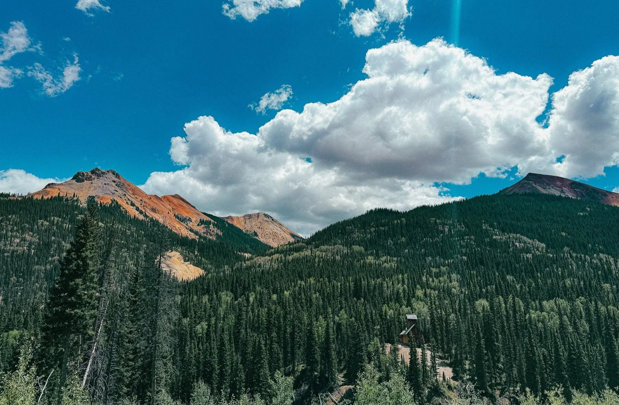
An old mining structure surrounded by forest and the mineral-colored mountains along the Million Dollar Highway.
Once you know some of this history, driving the Million Dollar Highway feels different.
The abandoned buildings aren't just interesting old structures.
The mine remains aren't random holes in the mountains.
And the road isn't simply an incredibly scenic way to get between Ouray and Silverton.
If you're planning to drive it, I also wrote about driving the Million Dollar Highway from Ouray to Silverton, including what the exposed sections are like and my experience driving it in both directions.
You're driving through what was once one of Colorado's important mining regions, following a transportation corridor that exists largely because people needed a way through these mountains more than 140 years ago.
I drove the road because I wanted to experience the Million Dollar Highway.
I ended up becoming just as interested in why it was there.
And now, the next time I drive over Red Mountain Pass, I know I'll be looking at a lot more than the drop-off beside me.
Frequently Asked Questions
When was the Million Dollar Highway built? The route has its beginnings in toll roads built through the San Juan Mountains during the mining boom of the 1880s. Colorado later improved the route for automobiles, completing what became known as the Million Dollar Highway in 1924.
Who was Otto Mears? Otto Mears was a Colorado road and railroad builder who helped develop transportation routes throughout the San Juan Mountains. He helped finance and complete the early toll road south of Ouray that became part of the route followed by today's highway.
Why was a road built between Ouray and the Red Mountain mining district? Mining created the need for better transportation through the mountains. Mines needed workers, equipment and supplies brought in, while valuable ore needed to be hauled out.
Was the Million Dollar Highway originally a toll road? Parts of today's route developed from an early toll road. Travelers paid to use the road that connected Ouray with mining areas farther into the San Juan Mountains.
When did the Million Dollar Highway become part of Colorado's highway system? Colorado took over and improved the route as automobile travel expanded in the early 20th century. The improved Ouray-to-Silverton highway was completed in 1924.
Michele Underwood writes Overland Girl, where she shares firsthand travel experiences across the American West — from desert landscapes and national parks to small towns layered with history. Her work blends movement, place, and the stories that shape them.Some posts may include affiliate links to products or services she uses on the road. If you choose to purchase through those links, she may earn a small commission at no additional cost to you. It helps support continued travel and storytelling. She only links to items she personally uses or would use herself.