
Rim Rock Drive at Colorado National Monument
The Red Rim Section, Scenic Pullouts, and What It’s Like on the Ground
Words by Michele Underwood | Photos by Michele
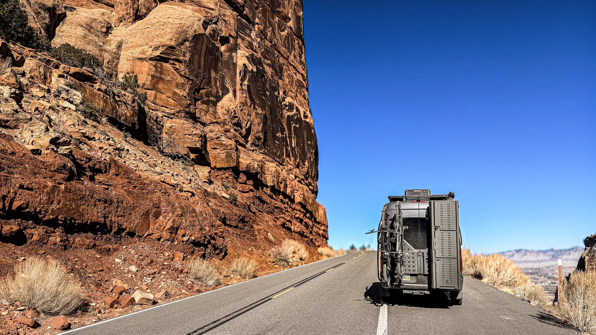
My van climbing Rim Rock Drive beneath towering canyon walls at Colorado National Monument.
Colorado National Monument sits on the western edge of Grand Junction, rising abruptly out of the valley in a series of red rock canyons and sheer cliff faces. You can enter the park from either Fruita or Grand Junction; I came in from the Fruita side and climbed onto Rim Rock Drive, following the road along the rim where the canyon walls fall away hundreds of feet below.
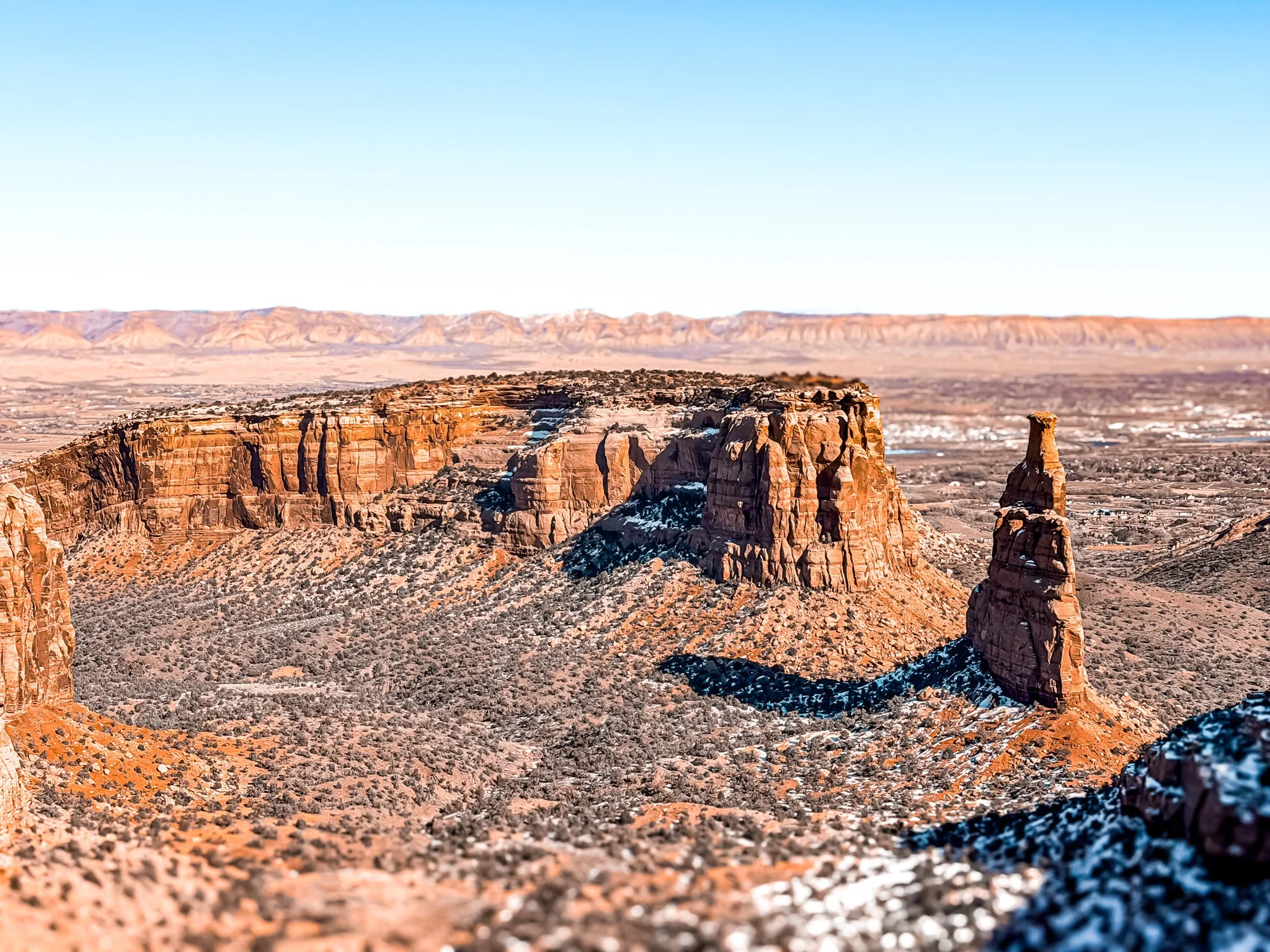
The Red Rim section is the stretch people talk about most — where the pavement narrows, the views open wide, and the road traces the edge of the cliffs. It’s not long, but it’s memorable, especially when the light hits the rock and the layers in the canyon start to separate.
Where Colorado National Monument Is Located
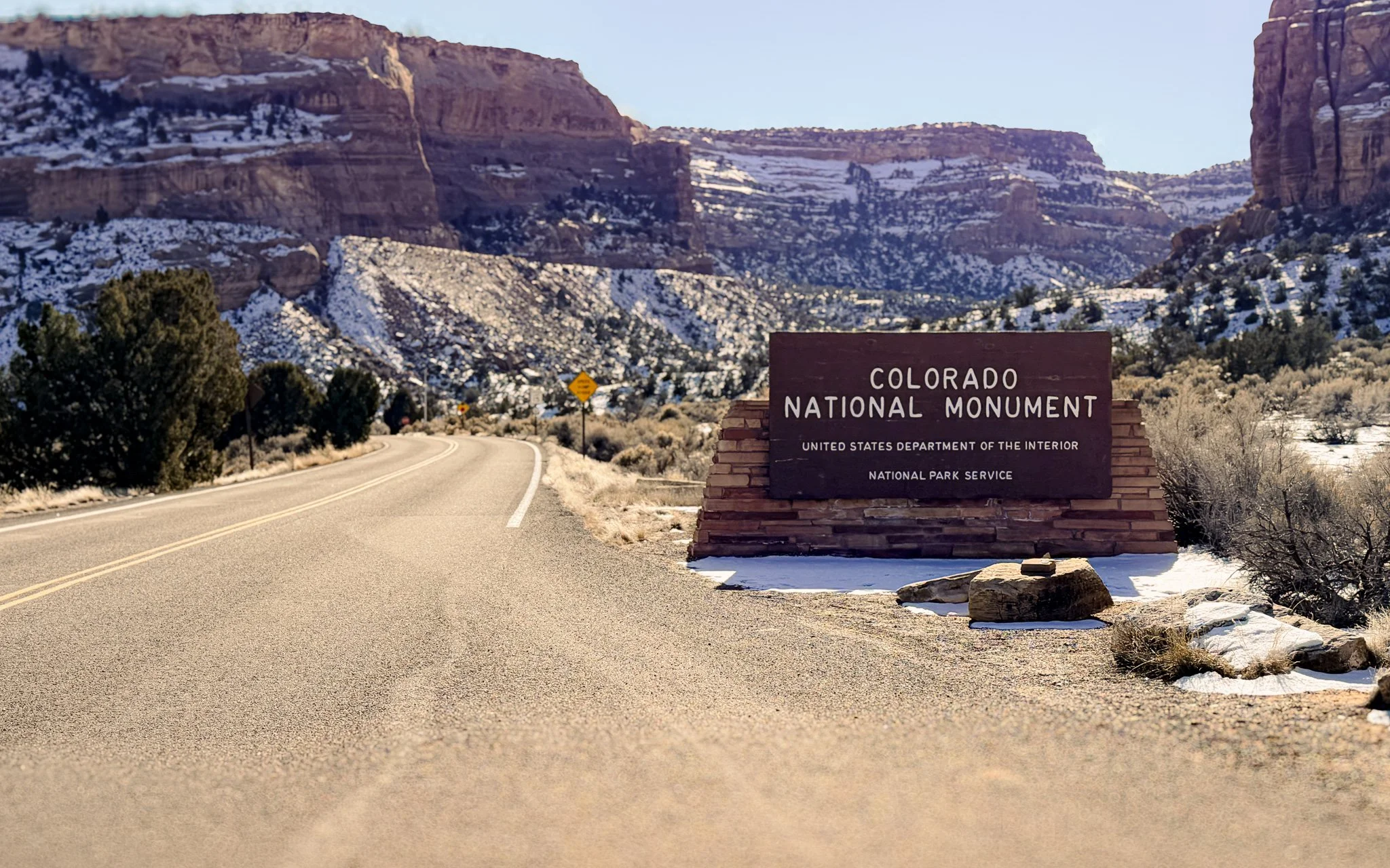
The Colorado National Monument sign near the Fruita side in winter.
Colorado National Monument protects a slice of canyon country along the edge of the Colorado Plateau between Fruita and Grand Junction in western Colorado. From the valley floor, the cliffs rise quickly; once you’re on top, the terrain opens into mesas, deep cuts in the rock, and long views across the Grand Valley.
This part of the state feels different from Colorado’s alpine zones. The monument sits in high-desert terrain — dry air, pale sandstone, stacked red walls, and wide horizons that sharpen the sense of exposure along the rim.
Rim Rock Drive: The Scenic Route Through the Park
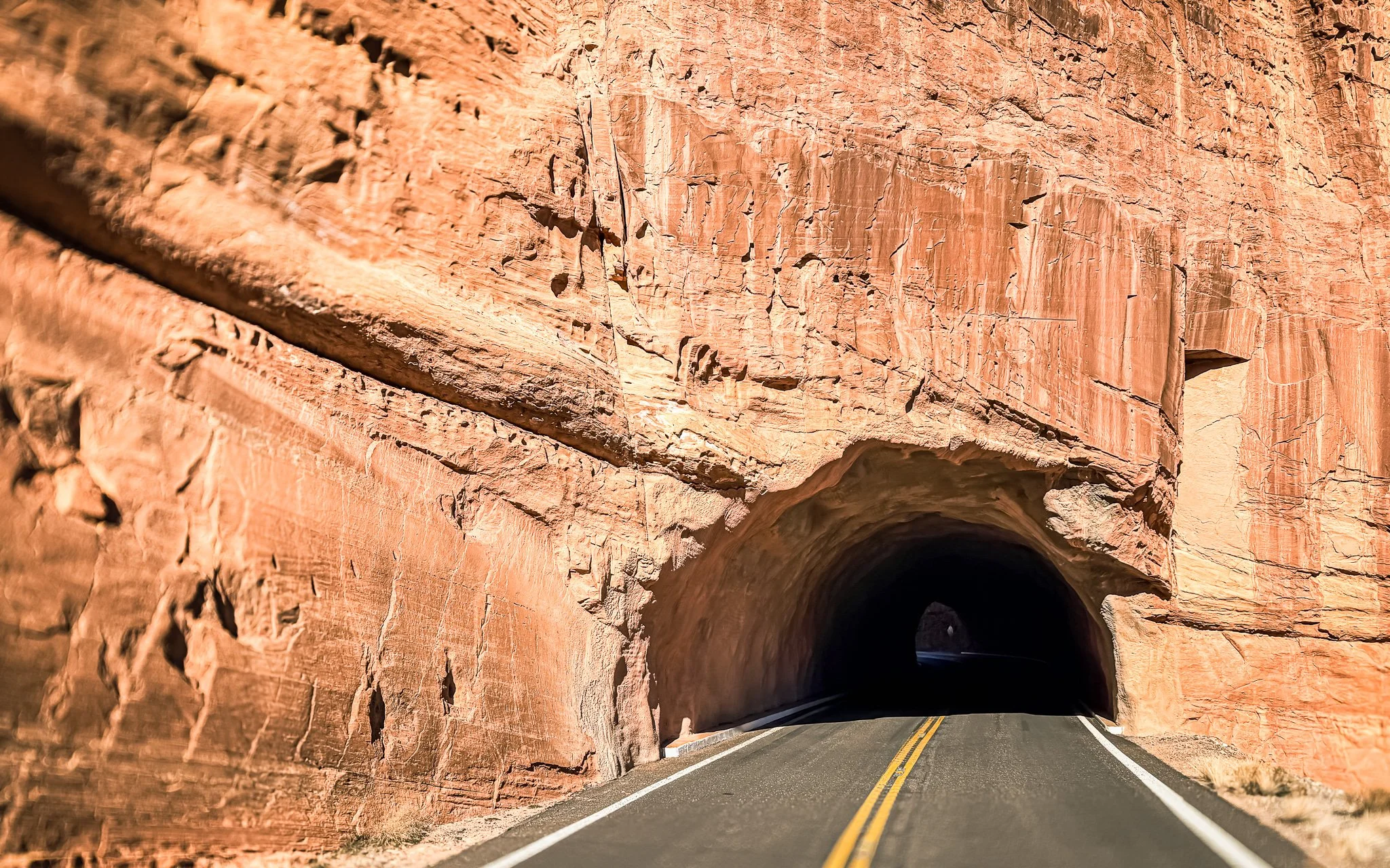
One of the tunnels along Rim Rock Drive inside Colorado National Monument from the Fruita side.
Rim Rock Drive runs roughly 23 miles across Colorado National Monument, starting near Fruita on the west side and ending above Grand Junction on the east. The road threads through tunnels carved into the rock and links a long series of overlooks along the canyon edge. It’s paved the entire way and marked with frequent pullouts, making it easy to stop, step out, and take in the scale of the terrain.
Some stretches feel wide and relaxed; others tighten as the pavement wraps around cliff faces. When I drove it in January, there was hardly any traffic, so I could pull off at viewpoints whenever I wanted.
Traffic varies by season, but winter and shoulder months can be especially quiet compared to spring and summer, when the monument sees more visitors and tour traffic.
Visitor Basics
Colorado National Monument charges an entrance fee and operates year-round, though winter weather can affect conditions along Rim Rock Drive. Speed limits are low, and vehicles longer than standard passenger cars should check current length restrictions before entering, especially because of tunnels and tight curves.
There is an entry station with a park ranger at each entrance. You can pay the fee at the gate or use a National Parks pass if you already have one.
Cell service is limited once you’re inside the park, so it’s worth downloading maps ahead of time. Fuel up before entering, carry water, and be prepared for quick shifts in weather at elevation.
Don’t forget to stop at the visitor center while you’re there.
National Parks Passport Stamps
If you collect National Parks passport stamps, bring your book — the visitor center has a stamp for Colorado National Monument. I got mine stamped while I was there.
The Red Rim Section of Rim Rock Drive
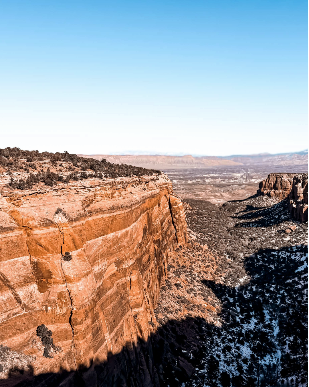
Looking out across canyon cliffs from Rim Rock Drive at Colorado National Monument.
The Red Rim portion is where Rim Rock Drive feels most exposed. The road hugs the canyon edge, the cliffs drop away sharply, and the rock shifts into deeper reds and oranges. It’s the part of the drive where you’re most aware of the elevation change from the valley floor to the rim.
Pullouts appear along the way, giving you space to step out and walk a few feet toward the edge for a better look down into the canyon system. The scale is immediate — sheer walls below, layered formations across the gap, and distant mesas stacked against the horizon.
Popular Views Along the Red Rim
Rim Rock Drive features numerous signed pullouts where the scenery opens up in different ways. Some of the most visited overlooks include:
Looking out from Independence Monument View along Rim Rock Drive at Colorado National Monument.
Cold Shivers Point – Panoramic views across the valley and into Columbus Canyon.
Grand View Overlook – One of the broadest views of Monument Canyon and the Grand Valley beyond, often cited as a must-stop.
Independence Monument View – A classic roadside look at one of the monument’s most iconic sandstone towers.
Artists Point – A great vantage point for layered rock formations and distant ridgelines.
Highland Overlook – Sweeping views toward the Book Cliffs and the valley below.
Upper Ute Canyon Overlook & Ute Canyon View – Great lookouts into Ute Canyon’s sculpted sandstone walls.
Red Canyon Overlook – A classic pullout with dramatic vertical walls and deep canyon colors.
These spots are all signed pullouts along the 23-mile drive and are easy to stop at if traffic allows — and in January, as you experienced, the road can feel almost empty, making it easy to choose your own viewpoint without crowding.
Below is a map of the overlooks along Rim Rock Drive.
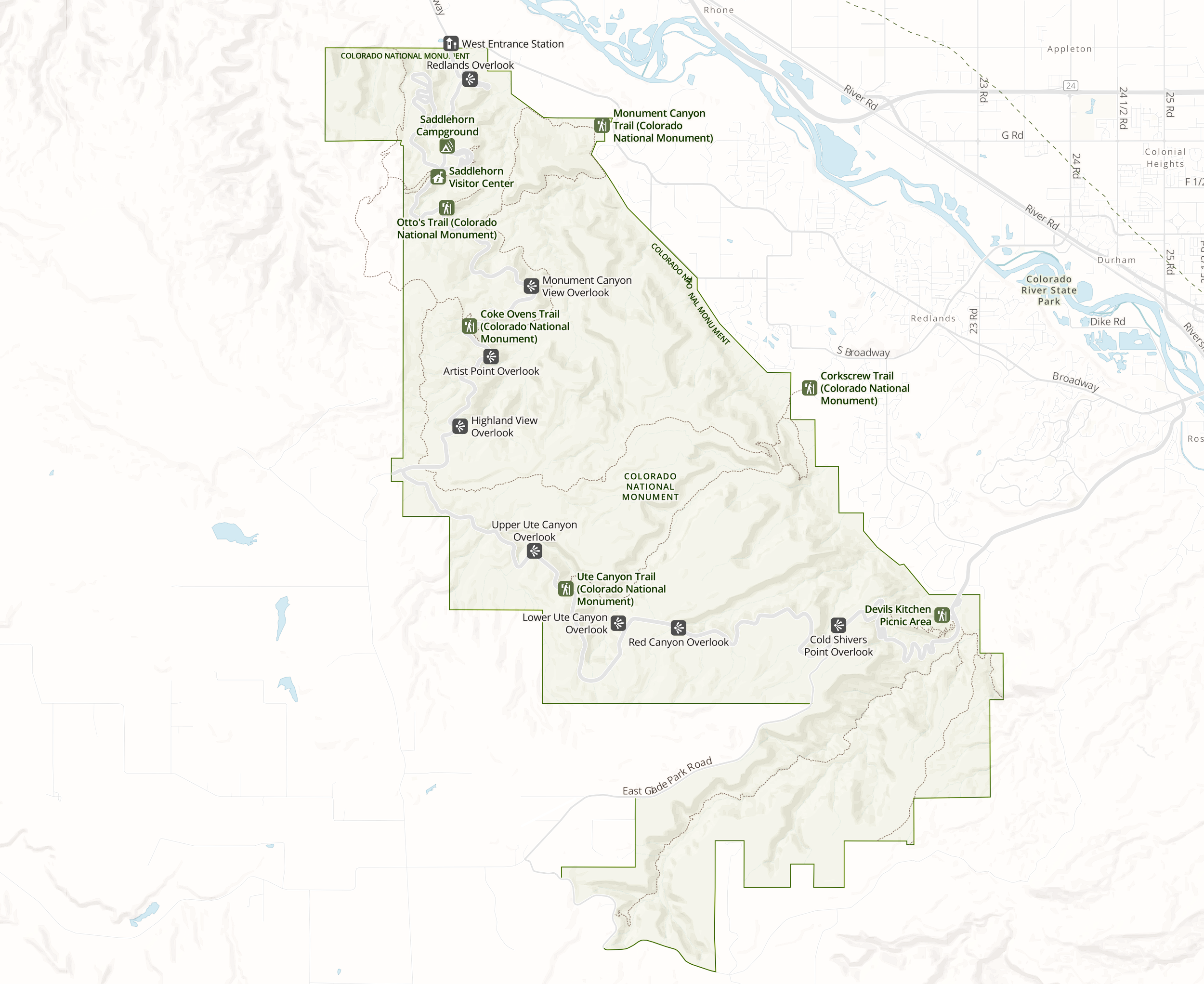
National Park Service map showing major overlooks and trails along Rim Rock Drive in Colorado National Monument.
Hiking Trails at Colorado National Monument
While Rim Rock Drive delivers most of the big scenery from the car, several trails drop into the canyons or follow the rim for closer looks at the rock formations and desert terrain.
Some of the most popular hikes include:
Monument Canyon Trail — A longer out-and-back route that descends into the canyon toward Independence Monument, giving a ground-level view of one of the park’s signature spires.
Serpents Trail — A historic switchback route that climbs dramatically from the canyon floor toward the rim, once used as an early access road before Rim Rock Drive was built.
Coke Ovens Trail — A shorter hike near Fruita that wanders past rounded sandstone formations and wide desert views.
Devils Kitchen Trail — A moderate loop with alcoves, sculpted rock walls, and close-up canyon scenery tucked below the rim.
Good Options for Families with Children
A few trails in the monument are often recommended for families because they’re relatively short and close to the road:
Coke Ovens Trail — Rolling terrain, interesting rock shapes, and room to explore without major elevation change.
Otto’s Trail — A short rim walk with views down into Monument Canyon.
Alcove Nature Trail — A brief interpretive loop near the visitor center that leads into a shallow rock alcove.
As with most hikes here, these routes are exposed and sunny, so water, sun protection, and cooler parts of the day matter—especially outside winter months.
Using Trailforks at Colorado National Monument
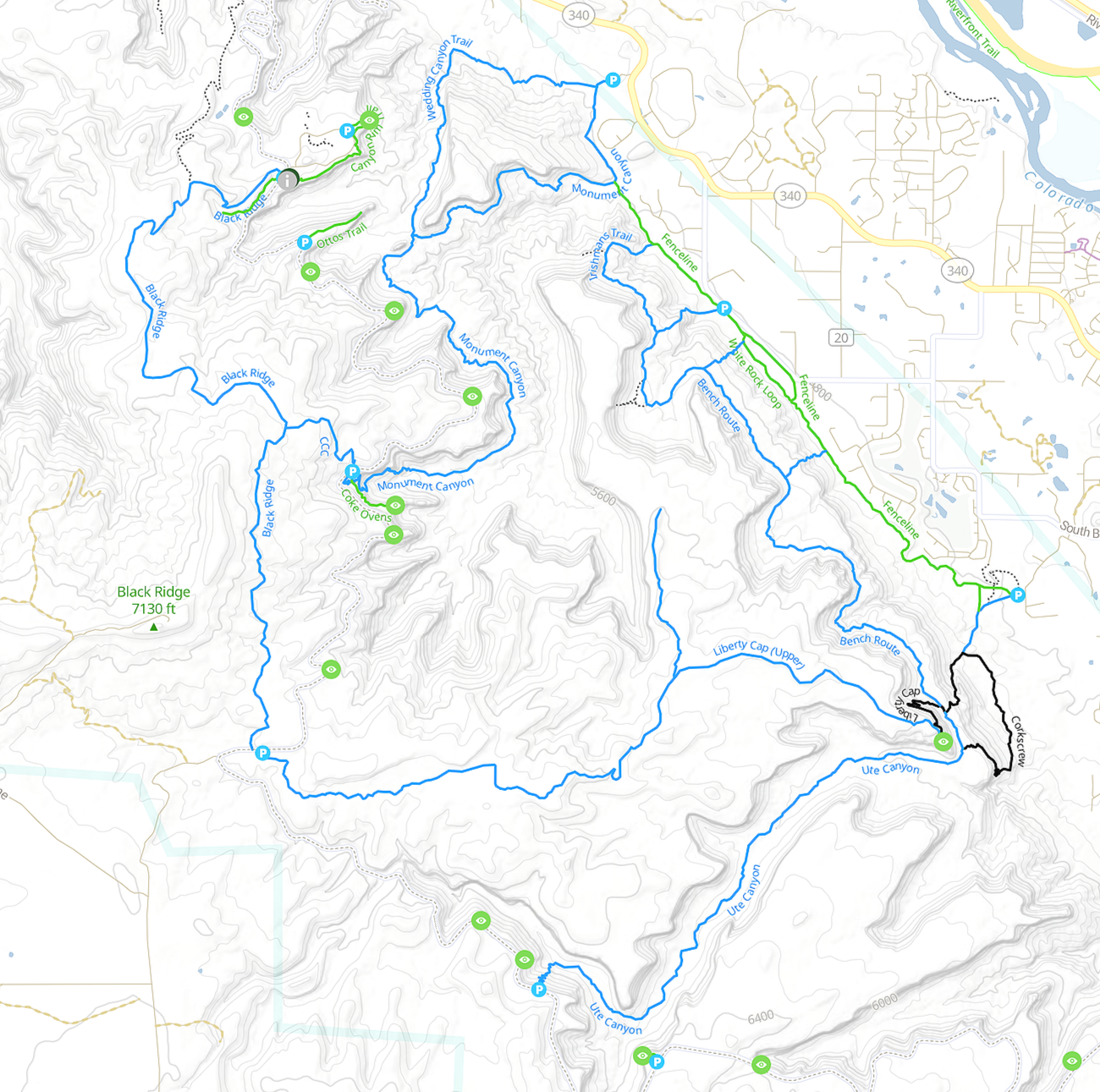
Trailforks map showing hiking routes and trail connections at Colorado National Monument.
If you use Trailforks, it’s a helpful way to preview trail routes, see elevation profiles, and locate trailheads around the monument before heading out on foot. The map also shows where many of the major landmarks are, which is useful when you’re trying to get oriented.
The History of Colorado National Monument
Colorado National Monument was established in 1911 after local booster John Otto began promoting the canyonlands outside Grand Junction as worthy of protection. He explored the area on foot and horseback, built early trails, guided visitors, and spent years lobbying for federal recognition before there was any paved road across the rim. President William Howard Taft eventually designated the monument, preserving the sandstone canyons and monoliths that rise above the Grand Valley.
Long before the monument existed, Indigenous peoples lived in and traveled through this region, leaving evidence of earlier use in the surrounding canyon country. In the late nineteenth century, ranching and settlement followed as western Colorado developed along the Colorado River corridor.
Before Rim Rock Drive was built, ranchers used steep, rough routes through what is now the monument to move livestock between valley pastures and higher summer grazing areas near Glade Park. One of those paths — known as the Fruita Dugway — climbed the cliffs from the Grand Valley and served as a stock route decades before scenic travel was the goal. I passed a sign describing how cattle were once herded up and down these same slopes, which is hard to picture now that the route feels so engineered for viewpoints and slow drives.
The modern version of Rim Rock Drive came later, during the 1930s, when Civilian Conservation Corps crews carved ledges into cliff faces, blasted tunnels through solid rock, and constructed many of the stone guard walls and overlooks that still define the road today. Their work turned what had been an isolated rim of canyon country into one of the most accessible drives anywhere on the Colorado Plateau.
Today, the monument protects a compact stretch of canyon-and-mesa landscape at the edge of western Colorado — shaped first by geology, then by ranching and early tourism, and finally by preservation.
Final Thoughts on Rim Rock Drive
Rim Rock Drive is one of those places that feels bigger than you expect when you first turn off the highway. The climb from the valley happens fast, and suddenly you’re tracing canyon rims with open space on both sides and layers of rock stacked into the distance.
Driving it in January, with almost no traffic, made it even better. I could stop when something caught my eye, walk out to the edge, and sit with the view for a minute without feeling rushed. Between the Red Rim stretch, the overlooks, and the short hikes along the road, it’s the kind of place that doesn’t need much planning beyond giving yourself time to pull over and look around.
It’s an easy drive to fit into a western Colorado trip, and one I was glad I didn’t rush.
See More Articles and YouTube Videos from This Part of Colorado
Michele Underwood writes Overland Girl, where she shares gear she uses on trips — from the Northwoods of Wisconsin to the Ozarks. She values quality and craftsmanship in everything she buys, from outdoor gear to everyday clothes and furniture. Her choices may seem expensive to some, but she believes in buying less and buying better. Longevity matters, both in terms of function and style. Her couch is five years old and still sold at Design Within Reach — that’s the kind of timelessness she looks for.
Some of the links in this review are affiliate links, which means she may earn a small commission if you buy through them. It doesn’t cost you anything extra, and it helps support her work. She only recommends gear she’d bring herself.