
Utah Rock Formations: A Guide to What You’re Seeing Across the State
Words by Michele Underwood | Photos by Michele
Sandstone hoodoos and sculpted rock formations in Devil's Garden in southern Utah.
I was in Utah from February through the end of April. Spring came in while I was there, and you could see how life grows in a dry climate—flowers pushing out of cracks in the rock and cactus blooming with bright color on each pad.
I was also introduced to these rock formations for the first time. The landscape can shift in color and type just by driving around a turn in the road.
Utah is defined by its rock formations, desert plants, and wildlife adapted to this harsh environment. From arches and hoodoos to cactus and sagebrush, the landscape changes depending on where you are in the state.
At first, it can feel like a mix of completely different terrain. But over time, patterns start to stand out. The formations begin to connect, the plants start to make sense, and you realize every part of this landscape has adapted to the same dry, rugged conditions.
In this guide, I’m focusing on the rock formations that define Utah. In the next guides, I’ll cover the desert plants and wildflowers I kept seeing on the trail, along with the venomous reptiles, insects, and other critters worth knowing about before heading out.
Rock Formations You’ll See Across Utah
Utah’s landscape is made up of a range of formations that repeat across the state. Once you start recognizing them, you’ll see the same patterns show up from one area to the next.
Arches
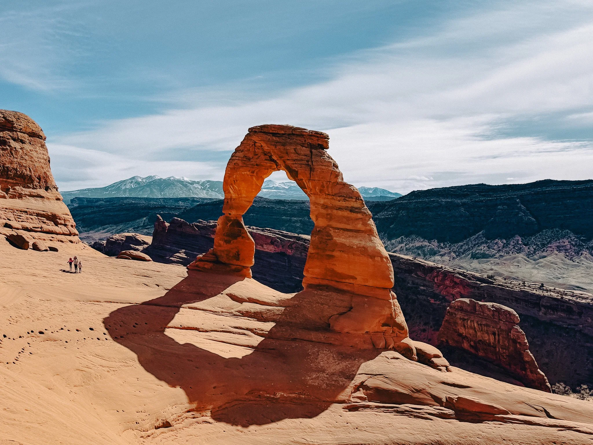
Delicate Arch in Arches National Park with views out across the surrounding desert landscape.
Arches form when cracks in sandstone widen over time, eventually opening into freestanding spans. Utah has the highest concentration of natural arches in the world, especially in Arches National Park and Canyonlands National Park. The most recognized is Delicate Arch near Moab.
Natural Bridges
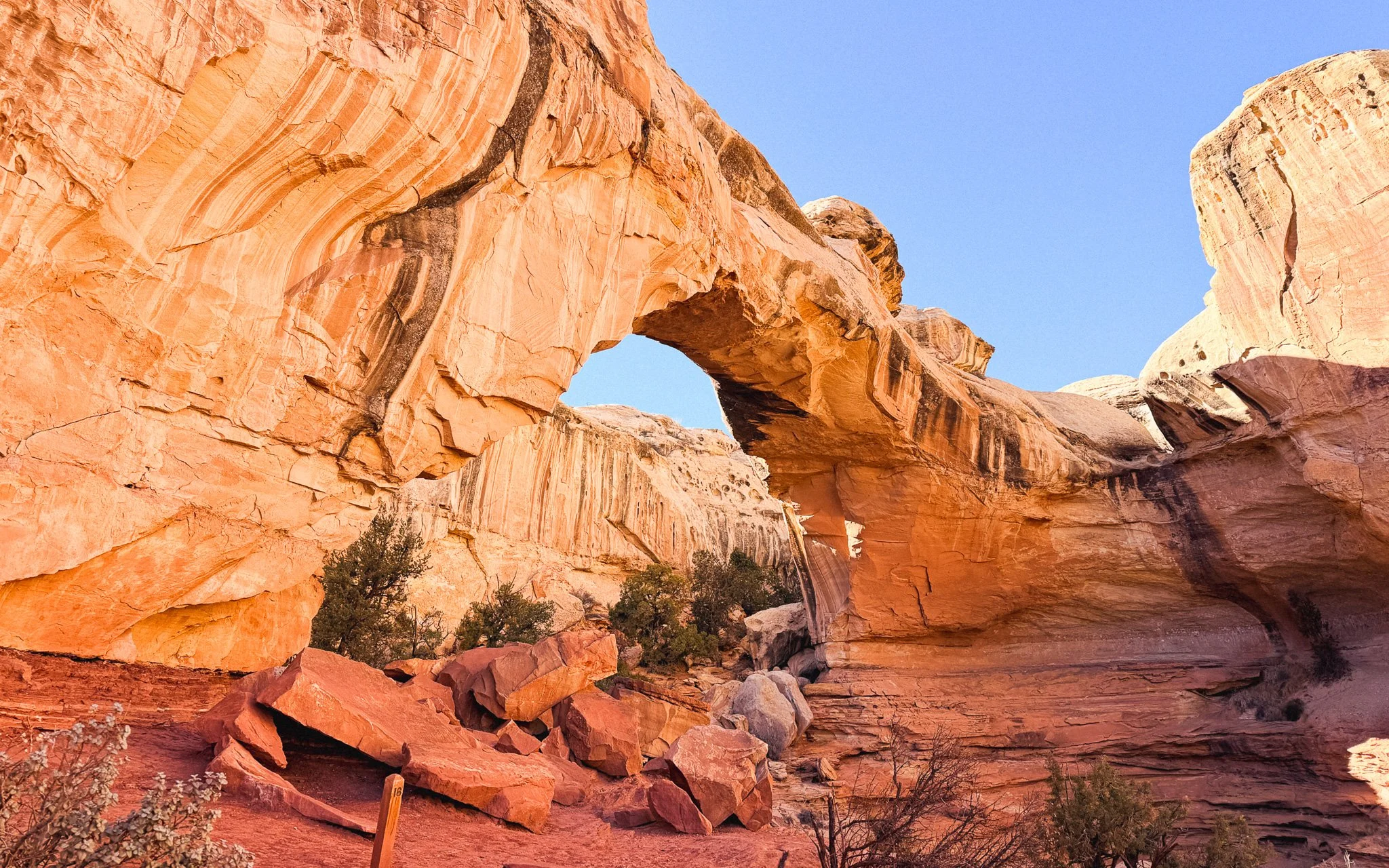
Hickman Bridge is one of the most impressive natural bridge formations I saw in Utah and one of the highlights of hiking in Capitol Reef.
Natural bridges resemble arches but form when water cuts through rock rather than opening from the side. They are thicker and feel more solid.
Buttes
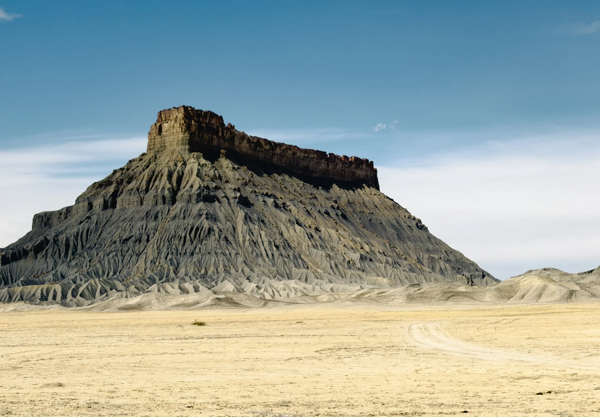
Factory Butte is one of the most dramatic buttes I saw in Utah, rising out of the desert with layers of rock and badlands surrounding it.
Buttes are steep-sided, flat-topped formations that stand alone in the landscape. They are what remains as the surrounding land erodes away.
Mesas
Mesas are larger and wider than buttes, with broad, flat tops and steep edges. Much of southern Utah is shaped by mesas, especially in Canyonlands National Park.
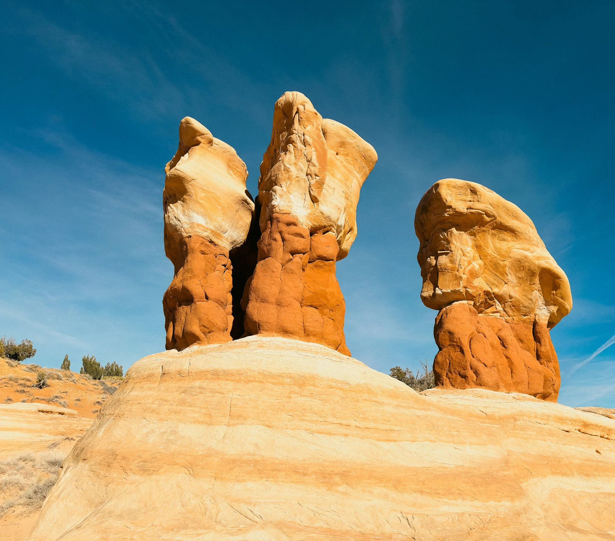
Hoodoos
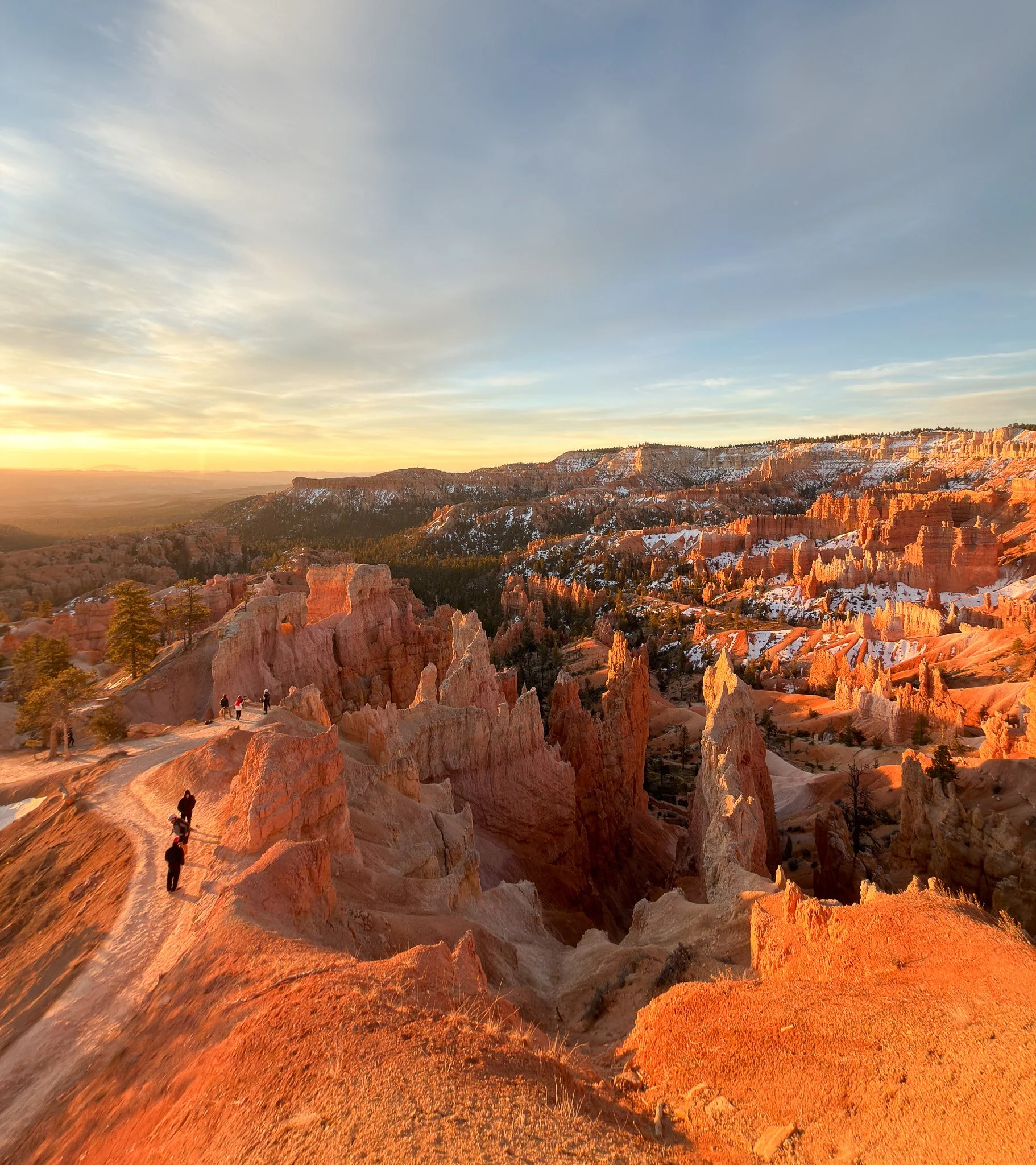
Sunrise over the hoodoos of Bryce Canyon National Park, where thousands of narrow rock spires shape one of the most unique landscapes in Utah.
Hoodoos are tall, narrow spires formed when softer rock erodes faster than the harder layer on top. The most concentrated examples are in Bryce Canyon National Park. Some formations look similar but are taller and more solid—these are often referred to as spires.
Fins
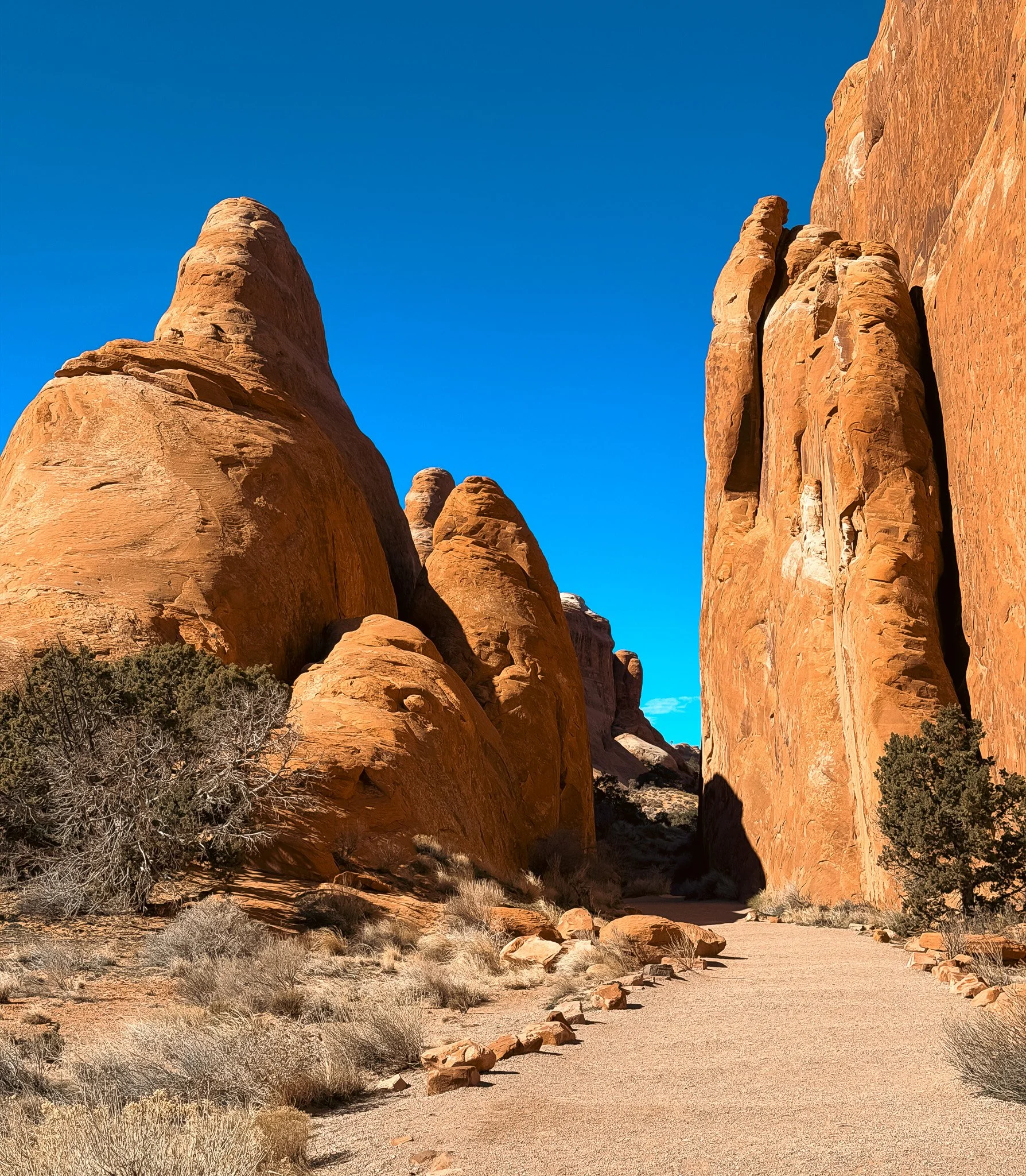
Towering sandstone fins in Arches National Park show how long vertical fractures in the rock can eventually form arches over time.
Fins are long, narrow walls of sandstone created by fractures that widen over time. As erosion continues, arches can form between them. These are common around Moab.
Balanced Rocks
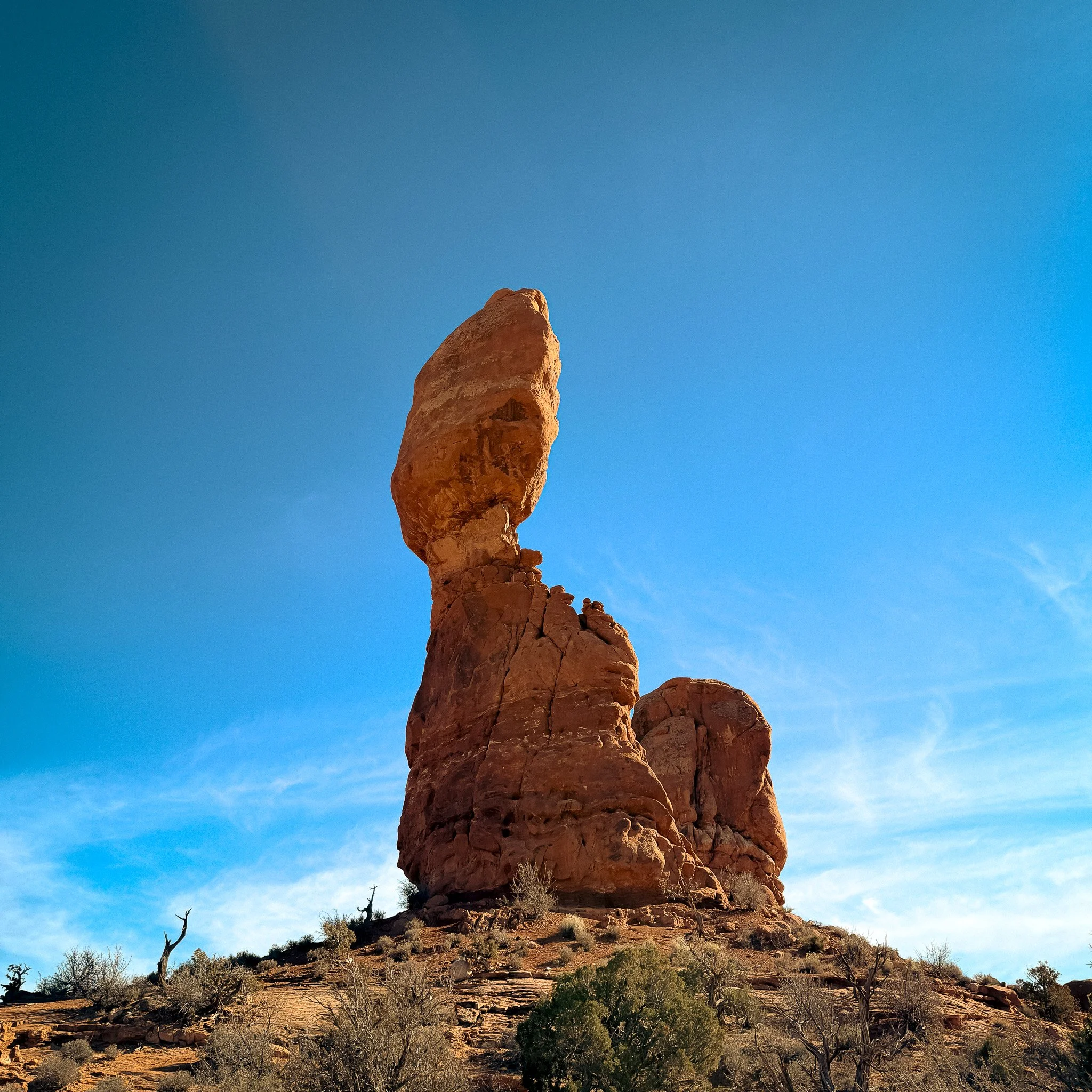
Balanced Rock in Arches National Park is one of Utah’s most recognizable balanced rock formations, shaped over time as softer rock eroded away beneath it.
Balanced rocks form when a harder rock sits on top of a softer base that erodes more quickly. The base wears down, leaving the upper portion standing.
Slot Canyons
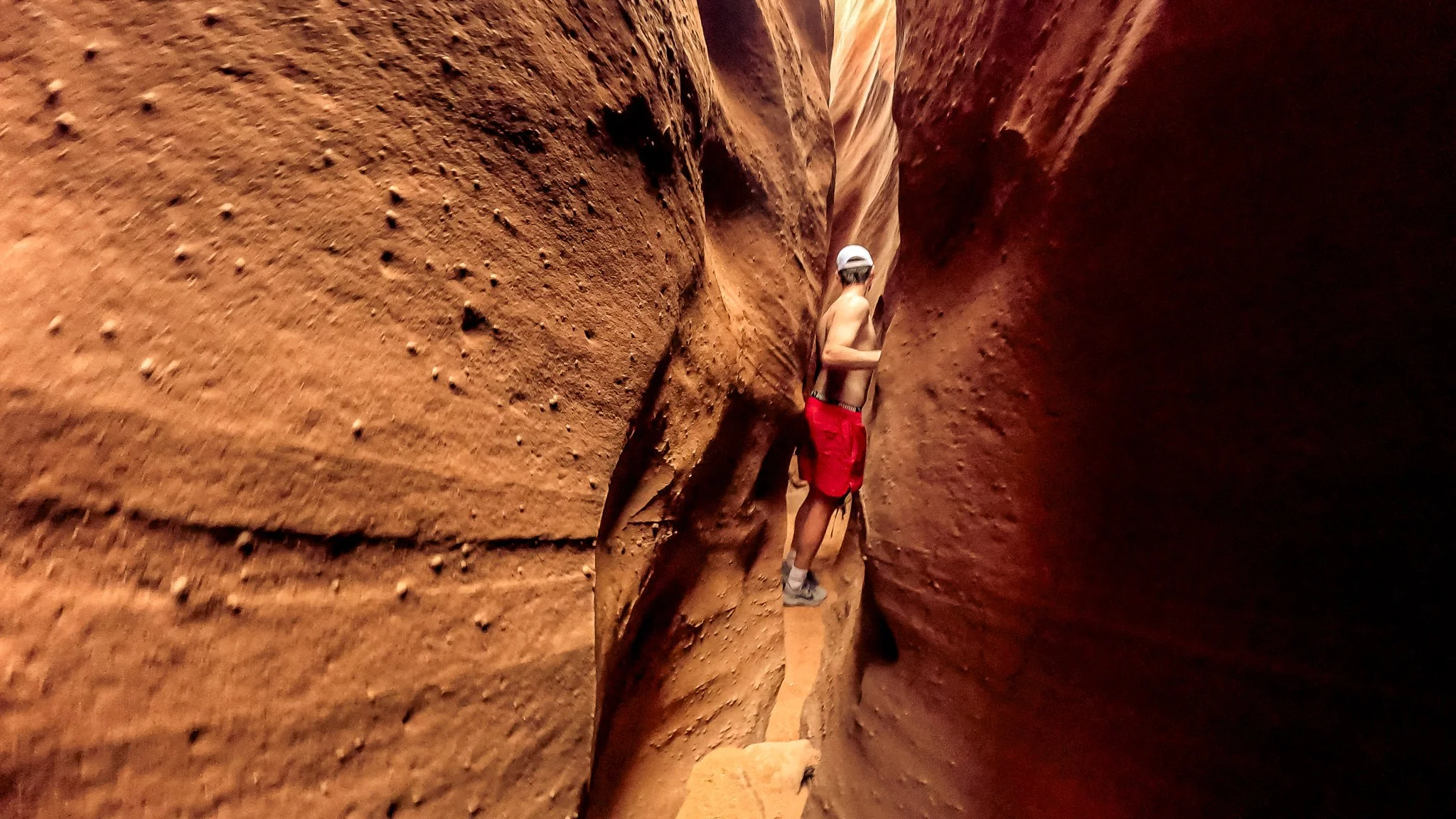
Slot canyons are narrow passages carved by water cutting through sandstone. They can be only a few feet wide, with walls rising high above you.
One of the best examples I experienced was Peek-a-Boo Slot Canyon and Spooky Gulch, where the canyon gets so tight you’re turning sideways to move through it.
Canyons and River-Carved Landscapes
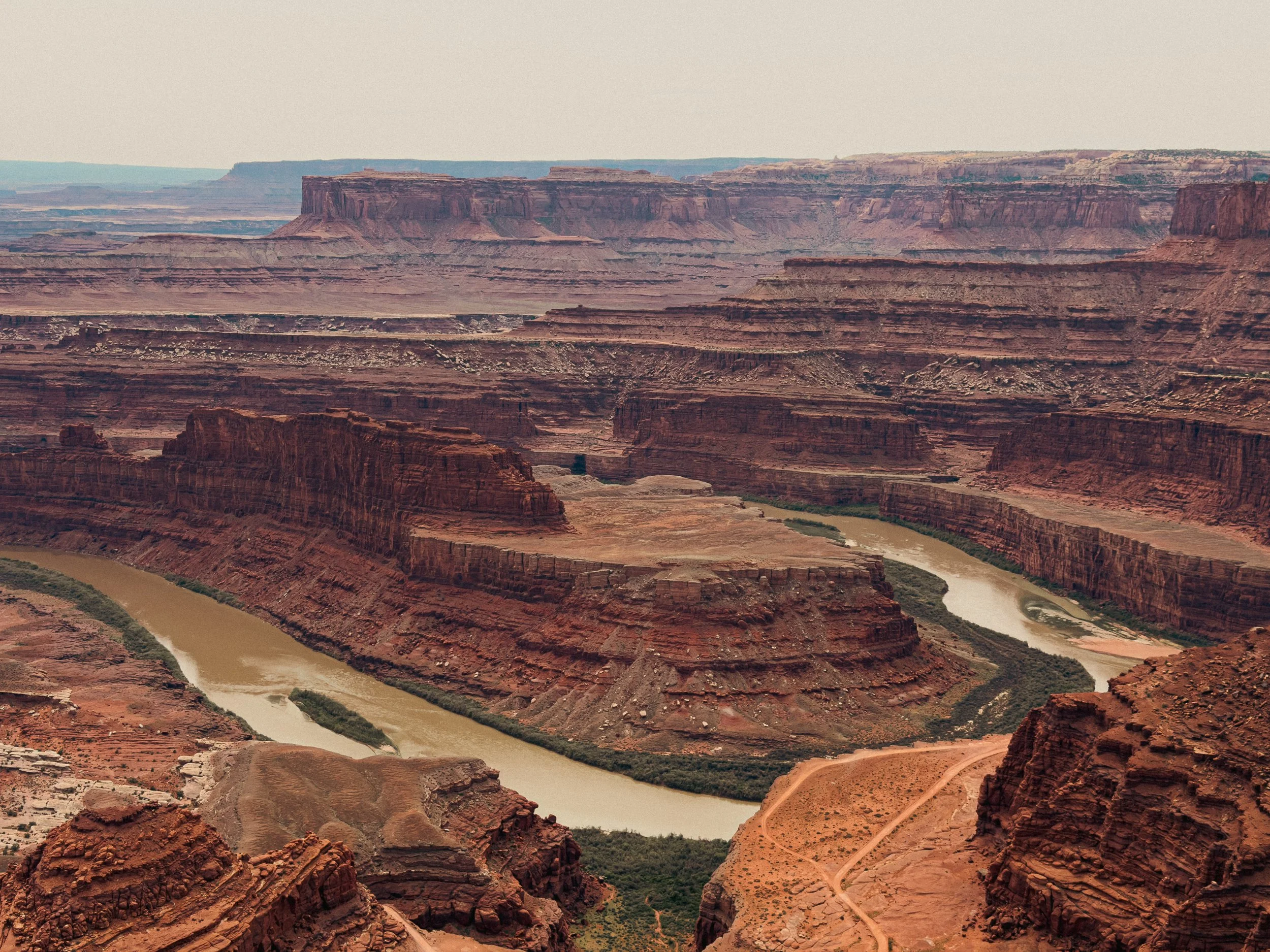
The Colorado River carving through the layered canyon landscape at Dead Horse Point State Park is one of the best examples of river-shaped terrain in Utah.
Beyond slot canyons, much of Utah is shaped by wide canyon systems carved by rivers.
These are the larger landscapes where you’re looking across layers of rock, often with a river far below. You see this throughout Canyonlands National Park and around Moab.
Domes
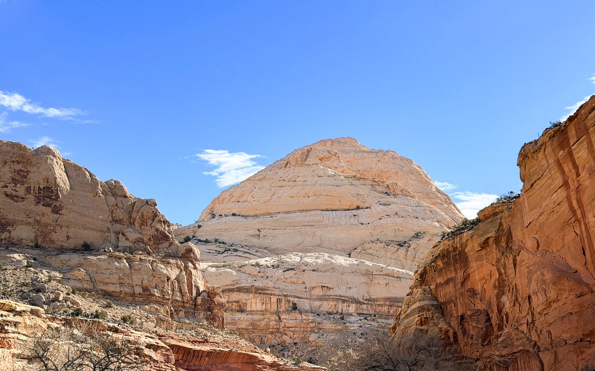
Rounded sandstone domes in Capitol Reef National Park are part of the smooth slickrock landscape that makes this area of Utah feel completely different from anywhere else in the state.
Domes, often called slickrock, are rounded formations shaped by uplift and erosion. The sandstone weathers into smooth, curved surfaces, creating rolling rock terrain in places like Capitol Reef National Park.
Sandstone Waves and Surface Patterns
In some areas, the rock has a wave-like pattern, with curved lines and ripples running through it.
These patterns show up across southern Utah and are especially noticeable in Grand Staircase–Escalante National Monument.
Petrified Sand Dunes
Petrified sand dunes in Sand Flats Recreation Area near the Slickrock trail system show ancient sand dunes that hardened into smooth Navajo sandstone.
Some of the rounded sandstone hills you see across Utah were once massive desert sand dunes. Over millions of years, those dunes compacted and hardened into stone, creating the smooth wave-like terrain you now see throughout southern Utah.
One of the best places I saw this was in Sand Flats Recreation Area outside Moab, where the landscape almost looks like frozen sand. It’s also where many riders experience these formations for the first time on the famous Slickrock trails.
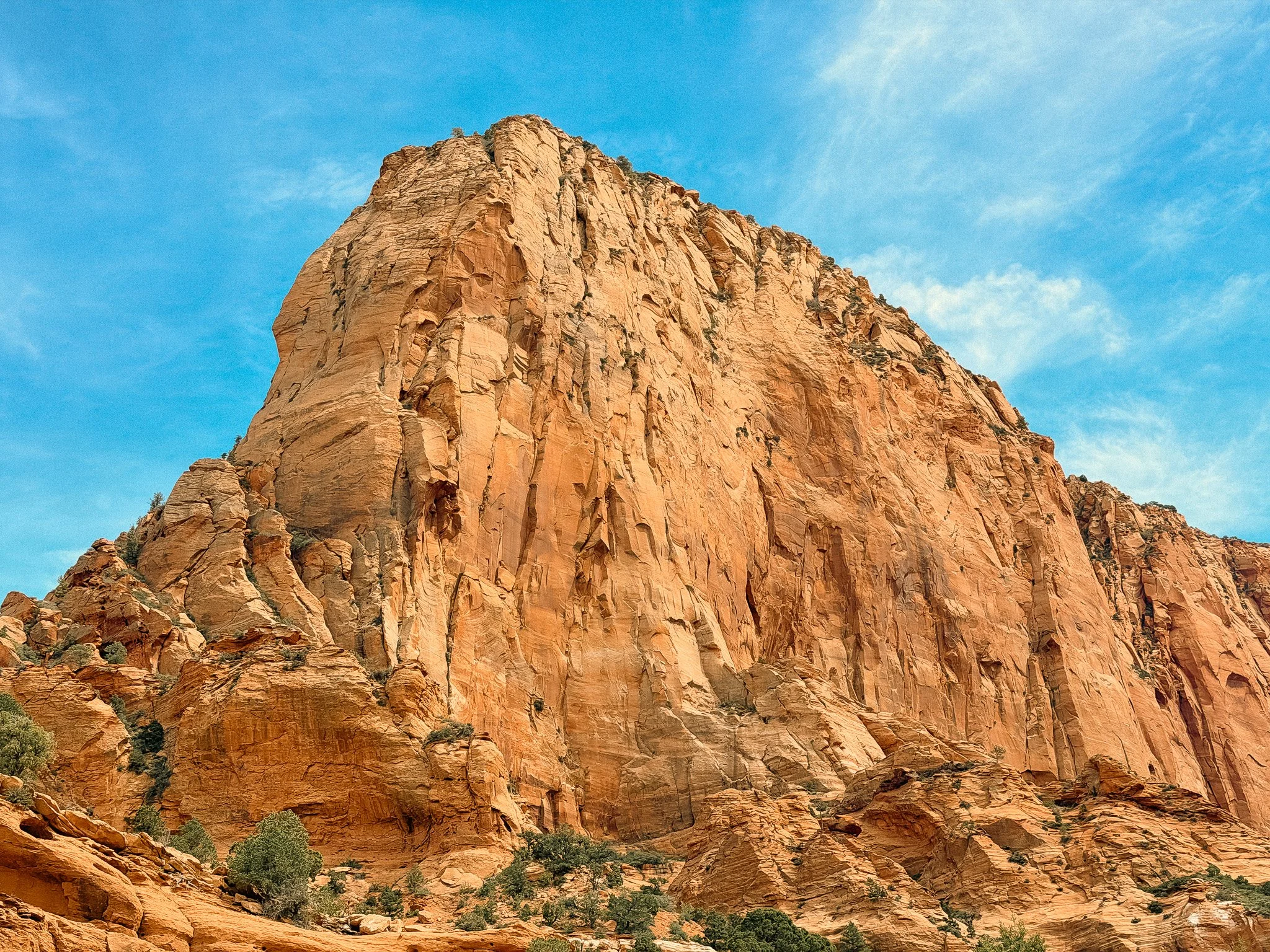
Rock Towers and Monoliths
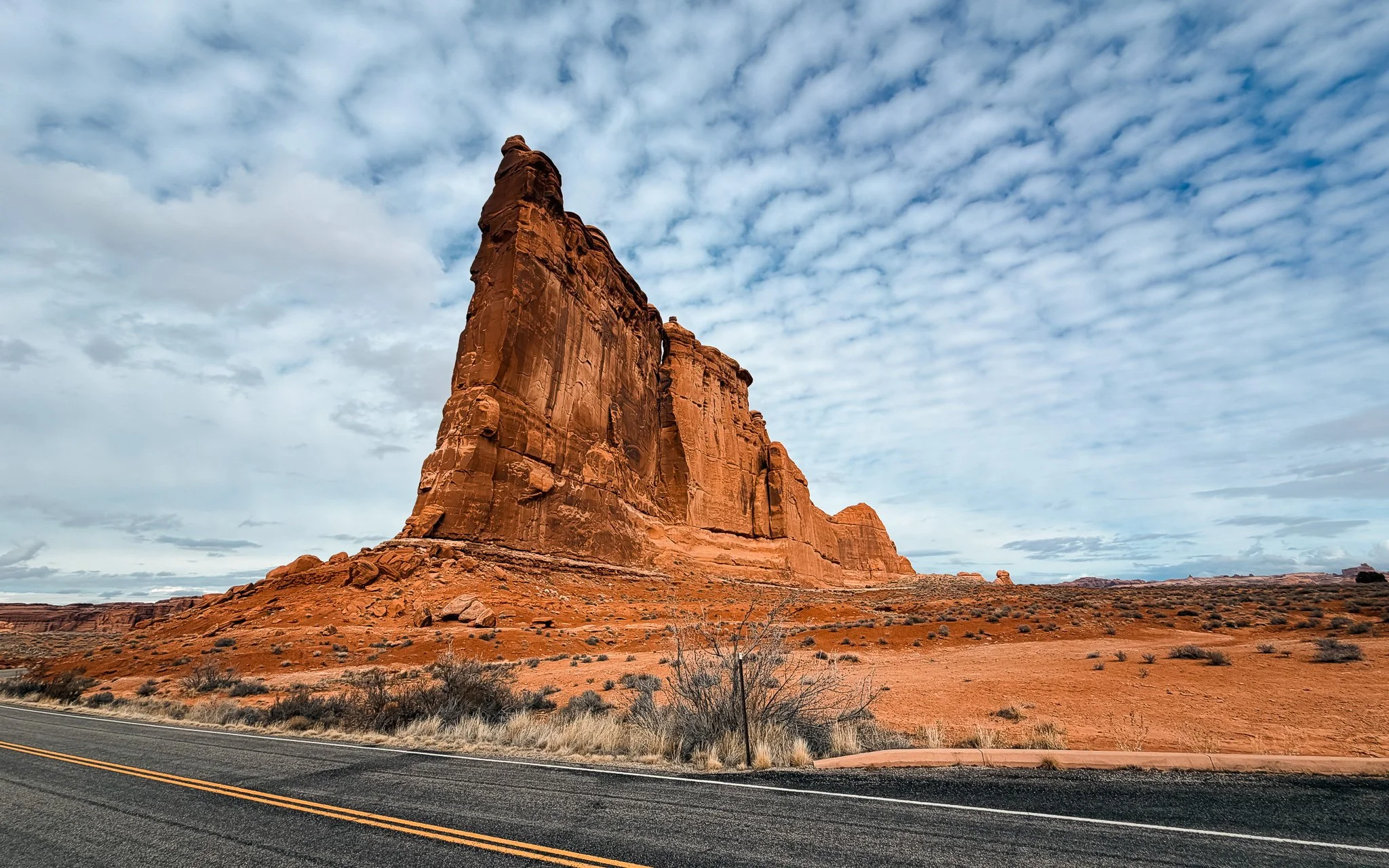
The Organ rising above the desert floor in the Park Avenue area of Arches National Park.
These are larger vertical formations that rise straight out of the landscape. They stand apart from cliffs and are bigger than hoodoos, often becoming defining features on the horizon.
Cliffs and Escarpments
Towering sandstone cliffs in Zion National Park show the massive vertical walls and exposed rock layers that define much of southern Utah.
Cliffs and escarpments expose layers of rock built up over time. Each band represents a different period, creating the stepped appearance seen across southern Utah.
Desert Features You’ll Also Notice in Utah
Washes
Washes are dry creek beds carved by seasonal water flow. Most of the time, they look dry, sandy, and easy to walk through, but during storms, they can fill quickly and become dangerous.
If you spend enough time hiking in Utah, you’ll walk through plenty of them.
Why Utah Looks This Way
Utah sits on the Colorado Plateau, a region made up of layered sedimentary rock that has been lifted over time. Erosion from wind, water, and temperature changes continues to shape the land.
Final Thoughts
Over time, the landscape starts to feel more connected. The formations relate to each other, and the plants follow the same conditions shaping the terrain. What first feels random begins to show structure, with each element tied to the same processes.
Keep Exploring Utah
If this guide helped you better understand Utah’s rock formations, keep going with the rest of this series.
→ Read next: Utah Desert Plants and Wildflowers: What I Saw Hiking Across the State (coming soon)
→ Read next: Venomous Reptiles, Bugs, and Wildlife in Utah: What to Watch For (coming soon)
Michele Underwood writes Overland Girl, where she shares firsthand travel experiences across the American West — from desert landscapes and national parks to small towns layered with history. Her work blends movement, place, and the stories that shape them.Some posts may include affiliate links to products or services she uses on the road. If you choose to purchase through those links, she may earn a small commission at no additional cost to you. It helps support continued travel and storytelling. She only links to items she personally uses or would use herself.