
Chattahoochee–Oconee National Forest Travel Guide: Hiking, Biking, Camping, and Forest Roads
Words by Michele Underwood | Photos by Michele
What and Where the Chattahoochee–Oconee National Forest Is
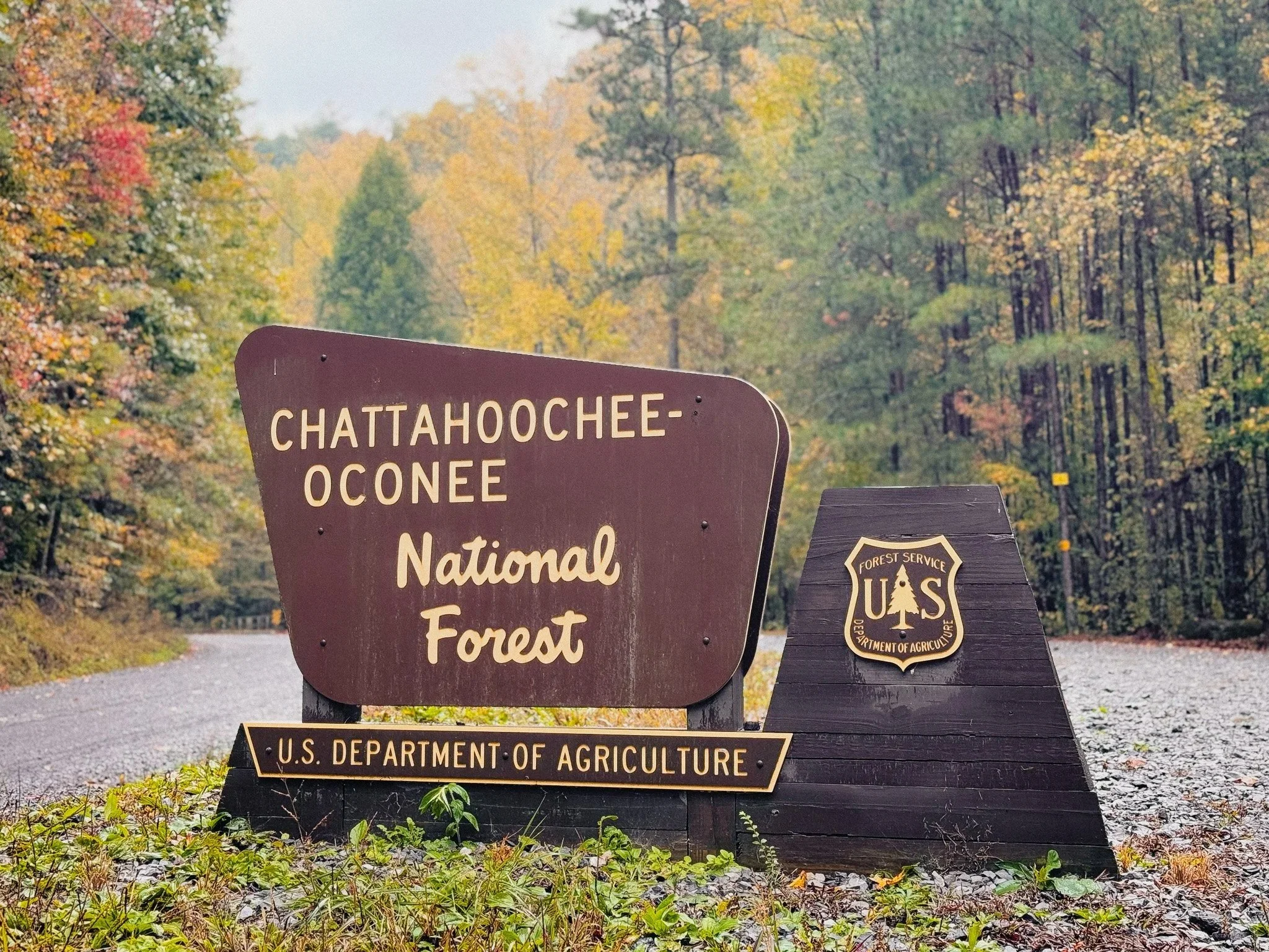
Chattahoochee–Oconee National Forest entrance sign in North Georgia.
The Chattahoochee–Oconee National Forest is actually two forests managed together: the Chattahoochee in North Georgia’s mountains and the Oconee farther south in the Piedmont. Most people mean the mountain portion when they talk about it — the part with ridgelines, rivers, waterfalls, and forest service roads threading through hardwood and pine forest.
It covers a massive area, and it doesn’t feel like one single park or trail system. It feels more like a network of zones — trailheads, rivers, campgrounds, ridges, and access roads — spread across North Georgia. Where you go matters more than the name on the map.
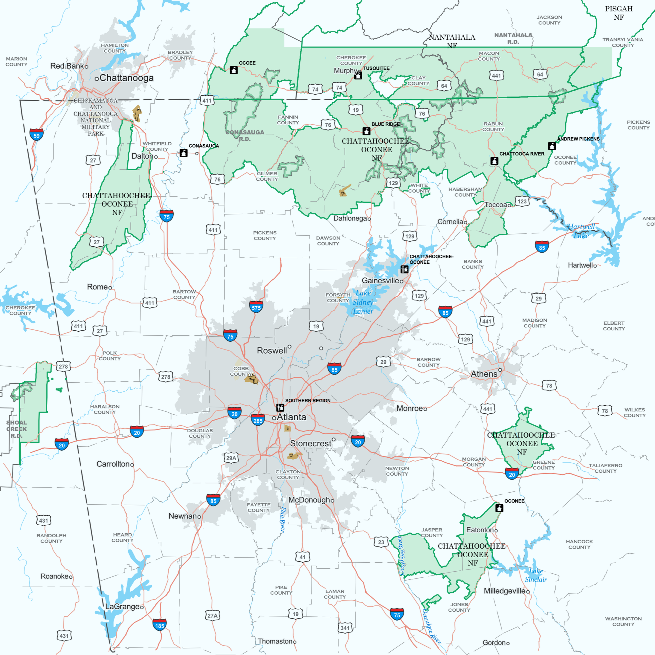
Map showing the full extent of the Chattahoochee–Oconee National Forest across northern and central Georgia.
Hiking in the Chattahoochee–Oconee National Forest
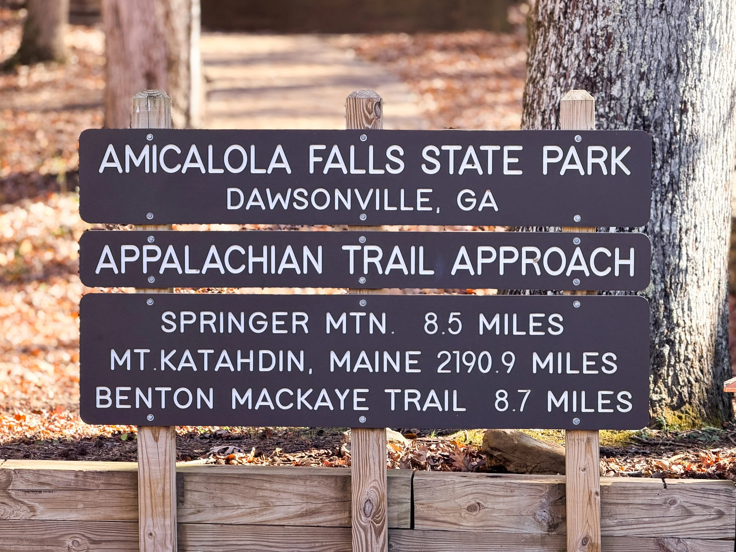
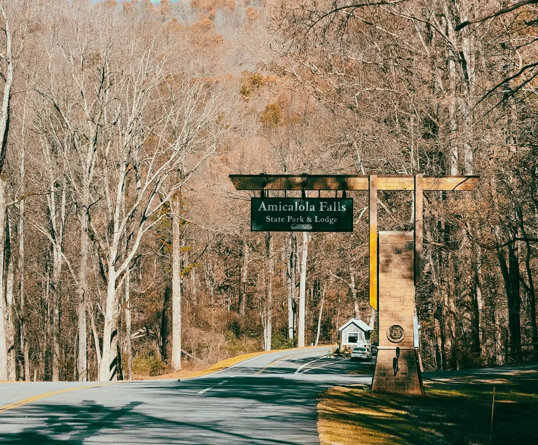
Trailhead sign for the Appalachian Trail Approach at Amicalola Falls State Park in Georgia.
Top hiking trails and areas
The southern terminus of the Appalachian Trail starts here, making this forest a gateway to one of the world's most well-known long-distance hiking routes. If you’re interested in longer routes or section hiking, this is where the Appalachian Trail system begins.
Springer Mountain (Appalachian Trail southern terminus) — I hiked a short section here.
Blood Mountain / Freeman Trail
Raven Cliff Falls
Dukes Creek Falls
Panther Creek Falls
Hiking here ranges from short waterfall walks to longer ridge and backcountry routes. The terrain changes quickly — you can move from shaded creek bottoms to exposed ridgelines in a few miles.
Some areas are more accessible and have higher traffic, especially near popular waterfalls and recreation areas. Others feel much quieter once you move a little farther from paved roads. If you like variety, this is a good place to build days with a mix of quick scenic stops and longer trail time.
Expect roots, rocks, uneven tread, and elevation change. This is not groomed-path hiking — it’s mountain forest hiking.
Mountain Biking and Gravel Riding in the Chattahoochee–Oconee National Forest
Top riding routes and areas
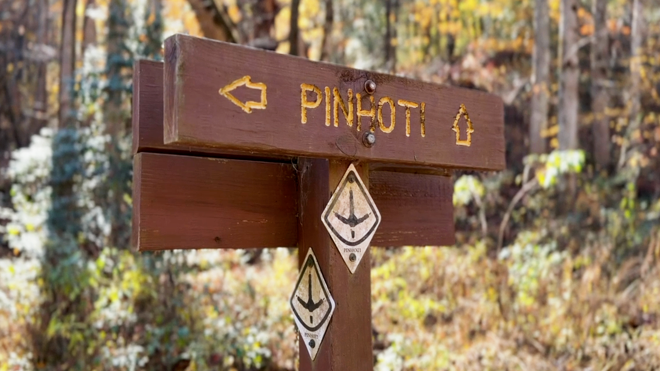
Pinhoti Trail sign at the Pinhoti 3 trailhead in North Georgia.
Pinhoti Trail (Georgia sections)
Bear Creek Trail (Cohutta / Mulberry Gap area)
Tanasi Trail System
Cohutta Forest Service road network
Conasauga / Jacks River gravel routes
There’s no single "main" mountain bike hub inside the forest the way there is in places like Bentonville or Pisgah, but there is a lot of rideable terrain.
You’ll find:
Segments of the Pinhoti Trail that pass through or connect to parts of the forest
Purpose-built trail systems near towns and recreation areas
Forest service roads that work well for gravel riding
Mixed-use trails where bikes, hikers, and horses share space
The riding leans more toward natural surfaces than machine-built flow, more in line with the style of riding you find in places like Pisgah. Think climbs, roots, rocks, and changing traction depending on weather and traffic. It’s a good fit if you like riding that feels connected to the landscape instead of engineered around it.
Check out my video — mountain biking Pinhoti 2: First Time Riding Pinhoti 2 | North Georgia Mountain Bike Trail Pre-Ride
Camping in the Chattahoochee–Oconee National Forest
Top camping areas
Cooper Creek Campground
Lake Winfield Scott Campground
Tallulah River Campground
Camping here ranges from developed campgrounds with facilities to dispersed roadside spots deeper in the forest.
You can:
Car camp or van camp near forest roads
Use established campgrounds close to trailheads and rivers
Backpack into more remote areas
Mulberry Gap Adventure Basecamp is located within the Chattahoochee National Forest and serves as a base for riding and hiking in the Cohutta and northern sections of the forest. You can read my review on Mulberry Gap: Mulberry Gap in Chattahoochee NF, GA—My Stay: Cabins, Meals & Trails.
Some zones feel busy, especially on weekends and holidays. Others get quiet quickly once you move away from popular access points. Flexibility helps — having a few backup spots in mind makes the experience much smoother.
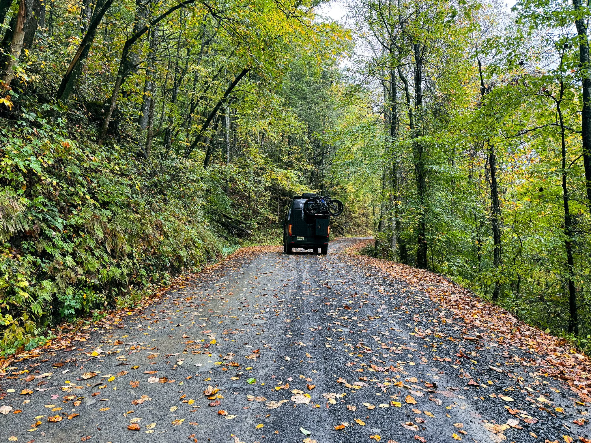
Forest Roads and Scenic Driving in the Chattahoochee–Oconee National Forest
Driving a forest service road in the Chattahoochee–Oconee National Forest.
Top forest roads and scenic routes
FS 64 (Cohutta / Mulberry Gap access)
FS 17 (Springer / Nimblewill area)
Tray Mountain Road
Brasstown Bald access road
Tallulah River Road
Forest service roads are a big part of how you move through this landscape. They connect trailheads, overlooks, camps, and river access, and they’re often part of the experience, not just a way to get somewhere.
Some roads are well-maintained gravel. Others are rougher, narrower, and slower. A higher-clearance vehicle helps, but you don’t need a dedicated off-road setup to explore most of the area.
If you like trips that involve wandering, pulling over at trailheads, and building days as you go, this is a place that supports that style of travel.
Waterfalls, Rivers, and Swimming in the Chattahoochee–Oconee Area
Water is a defining feature of North Georgia. From high-volume waterfalls to clear mountain creeks and wide river corridors, water shows up everywhere — along trails, beside forest roads, and in easy roadside pull-offs.
Some of the most popular and visually striking water features in the region include:
Top waterfalls and river areas
Amicalola Falls (near the southern edge of the forest)
At 729 feet, Amicalola is the tallest waterfall in Georgia and the best-known in the state. It’s technically in Amicalola Falls State Park, just outside the forest boundary, but it’s impossible to talk about North Georgia waterfalls without including it.
Check out my video on Amicalola Falls — Hiking Amicalola Falls to the Top in the Fall
Anna Ruby Falls (Helen area)
Twin waterfalls on a short, paved trail near Helen. One of the most visited and accessible waterfalls in the region.
Raven Cliff Falls
A tall, narrow waterfall at the end of a scenic creek-side hike near Helen. One of the most popular waterfall hikes inside the forest.
Dukes Creek Falls
A series of cascades and overlooks near Helen, well-maintained and popular for its views and salmon hatchery access.
Panther Creek Falls
A larger, more dramatic waterfall near Clarkesville with a pool below. Popular with hikers looking for something a bit more rugged.
High Shoals Falls and Blue Hole Falls
A pair of waterfalls on the High Shoals Trail, with Blue Hole offering one of the better natural swimming spots in the forest during summer.
Tallulah River Corridor
A long river corridor with campgrounds, pull-offs, wading spots, and access for fishing and tubing. Less about one big waterfall and more about consistent river access.
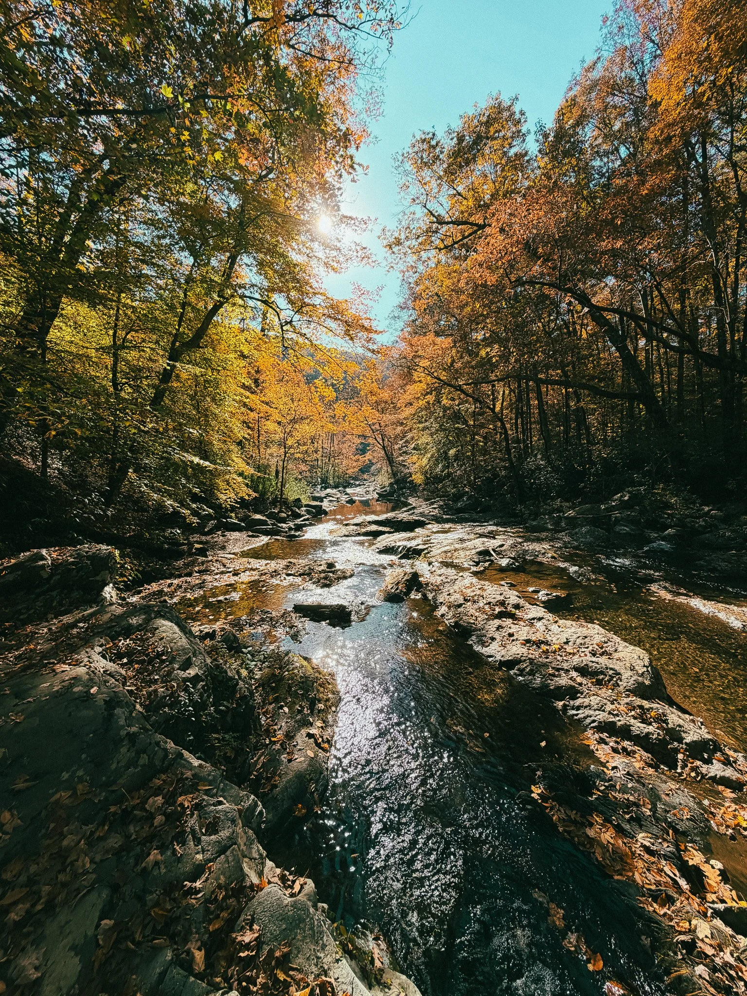
Emery Creek near the trailhead in the Chattahoochee–Oconee National Forest.
What you’ll find here
Across the forest and surrounding area, you’ll find:
Big, high-volume waterfalls with platforms and overlooks
Short hikes to roadside falls and longer hikes that follow creeks upstream
Cold, clear swimming holes tucked along trails like High Shoals and Panther Creek
Wide river corridors like the Tallulah and Chattooga for wading, tubing, and relaxing
Flow varies by season — spring is the most dramatic for waterfalls, while late summer is better for swimming and creek time — but water is almost always part of the experience in some form.
How the Chattahoochee–Oconee Is Laid Out
Compared to places where everything revolves around a single base town — like staying in Blue Ridge or Ellijay and driving out to trails from there — the Chattahoochee–Oconee feels more spread out. You don’t arrive in one place and do everything from there — you move between trailheads, river access points, camps, and forest roads depending on what you want to do.
Compared to Pisgah National Forest, it’s less dense in terms of trail concentration but more open and flexible. It’s easier to combine different kinds of activities in a single trip: hiking one day, riding another, camping somewhere quiet, then moving on.
Practical Planning Notes for Visiting the Chattahoochee–Oconee National Forest
Cell service is inconsistent once you leave towns and highways
Offline maps are helpful for navigation
Road conditions vary by area, and after storms
Popular spots get busy on weekends
Many trailheads and roads are not well signed
Trailforks: The easiest way to see which trails exist, what’s rideable, and how they connect. If you often ride or explore new areas, it’s worth using the full version to save maps for offline use and view the latest trail status. There is little to no cell service in the forest. You can subscribe to Trailforks to access those features.
Final Notes on Visiting the Chattahoochee–Oconee National Forest
Chattahoochee–Oconee isn’t one trail, one campground, or one viewpoint. It’s a wide, layered landscape where you build your own version of the trip — riding, hiking, camping, driving, or some mix of all of it.
If you like places that feel open-ended and not overly packaged, this forest works well. It gives you room to explore, move around, and shape the experience based on what you’re in the mood for instead of following a fixed itinerary.
Michele Underwood writes Overland Girl, where she shares gear she uses on real trips—from the Northwoods of Wisconsin to the Ozarks. She values quality and craftsmanship in everything she buys—from outdoor gear to everyday clothes and furniture. Her choices may seem expensive to some, but she believes in buying less and buying better. Longevity matters, both in terms of function and style. Her couch is five years old and still sold at Design Within Reach—that's the kind of timelessness she looks for. Some of the links in this review are affiliate links, which means she may earn a small commission if you buy through them. It doesn’t cost you anything extra, and it helps support her work. She only recommends gear she’d bring herself.